Showing posts with label hill climbing. Show all posts

Friday, September 25, 2009

Climbing Hurricane Ridge

I've been itching to do some more high-elevation riding, especially since the warm season is soon ending and I want to squeeze all I can out of the current nice weather. At first I was thinking of doing Snoqualmie Pass (starting from Seattle) for my "one last pass" ride of the season, but I've already done it a few times and though I was going to explore the backroads up it, I set my sights on something else, something new.

Hurricane Ridge - out on the Olympic Peninsula, this gem of a climb came on my radar last year when it was closed to cyclists due to washouts. 28km at about a 5% grade, what's not to love?


Though I've previously spoke of riding out to this climb - that was too much of an undertaking for what I had in mind, so Kira & I drove out to Port Angeles so I could start the climb fresh and we could meet up at the top. I'm really glad we did this, since from Kingston (or Bainbridge) I'd forgotten how hilly Highway 104 is! It had some serious climbs that looked painful on the way to a big climb. Huge thanks to Kira for taking me out here - we made a great day of it.


But on to the cycling. I started at the bottom visitors center, about 17 miles from the top. Didn't really warm-up, just hit the climb and made sure to stay in the little ring (39 tooth) at first - which was easy to do since it starts out at about a 6-7% grade for the first 8 km or so.


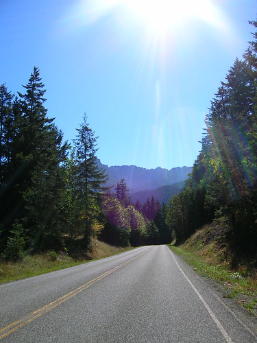
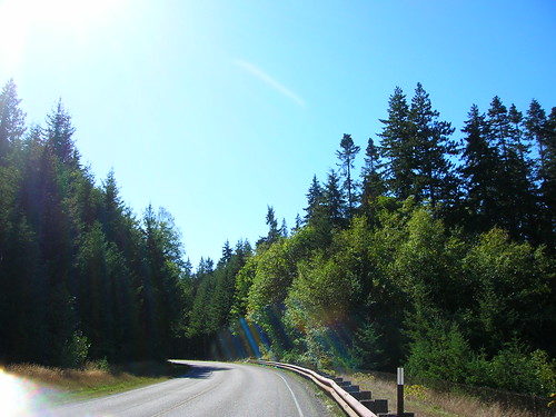
The road starts as worn chip-seal surrounded by greenery that would soon turn more sparse and more alpine.
While I was keeping the pace in the Tempo zone, I was also taking a little time to take in the scenery and capture a few shots like this. It was the perfect day for a climb in short sleeves - it might be a while before I get to do this again. (Snow is expected at the top on Monday!)


In the middle or so of the climb I felt that it was time to kick it into the big ring (53 teeth) and push it. The road wasn't as steep in the middle section of the climb, and I could feel it since the pedaling was getting easier. So I kicked it up a notch. Sometimes I can hit a "sweet spot" on climbs where a 53x23 gear feels just right, and keeps me going relatively fast. Towards the end I could see my heart rate start to rise and my legs start to get sore, but I kept on truckin' for the first hour at least to see if I could set a new personal record (see Data section below).

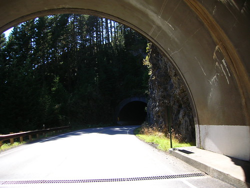
There are three small tunnels to go through, but they're short and traffic was light anyway.
I used a rear flashing light just in case.


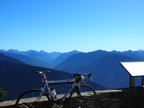
After this the road gets pretty twisty and kicks up a bit (6% for the last few miles at least), and you start to see the views you've come to hope for. You can see the top of the road up to your left as you near the top, cars glistening in the sun light, but looking really high up too. I thought to myself, am I really going that high in this short of a distance? Ouch.

Right as I hit the one hour mark I let up, happy to have pushed hard for an hour, and took it easy the rest of the way. Enjoying the scenery, which is easy to forget to do sometimes if you zone out staring at your front wheel.

The scale of these views/climbs can be overwhelming sometimes but that's why I love it. I love the humbling feeling of looking over a mountain vista, up at a star-filled sky, or at an ocean view and thinking about how insignificant we are. Oh and it was a great workout too.

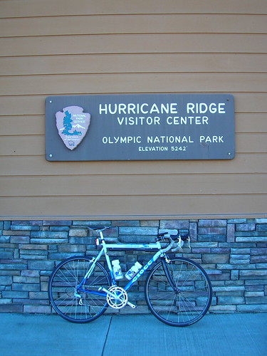
5,242 ft at the top Visitors Center at Hurricane Ridge. I bought a coffee mug as a souveneir.

A few more photos here, and Kira took some great shots of some wildlife there as well. (Thanks again for the ride!)

Data

Set a new peak one hour record. My previous best was back in April, 243 watts for one hour (was on a SiR winter training ride). The season of riding and racing has increased my capacity to turn the pedals harder for an hour, and this time I came out at 268 watts. Perhaps could have "scored" higher with more effort (HR average was just 156 bpm, max is 196). Anyway it's nice to see a noticeable increase in the data as a result in training.

Peak 60min (268 watts):
Duration: 1:00:00 (1:01:37)
Work: 966 kJ
TSS: 91.3 (intensity factor 0.955)
Norm Power: 272
Distance: 17.946 km
Elevation Gain: 991 m
Grade: 5.1 % (916 m)
Min Max Avg
Power: 112 565 268 watts
Heart Rate: 93 175 156 bpm
Cadence: 16 87 64 rpm
Speed: 0.4 51.6 17.9 kph
Crank Torque: 0 169.9 40.8 N-m

Data for the full ride.

Entire workout (251 watts):
Duration: 1:40:34 (1:43:32)
Work: 1514 kJ
TSS: 137.8 (intensity factor 0.907)
Norm Power: 258
Distance: 27.624 km
Elevation Gain: 1659 m
Grade: 5.4 % (1477 m)
Min Max Avg
Power: 0 565 251 watts
Heart Rate: 93 175 155 bpm
Cadence: 16 87 62 rpm
Speed: 0 51.6 16.5 kph
Crank Torque: 0 177.1 38.9 N-m

I definitely want to do this climb as part of a full ride next year! It'll be worth the slog out there.

Saturday, January 31, 2009

Saturday Hill Ride

After a walk to downtown and back (which sometimes seems more taxing than a bike ride), I went out for an hour's worth of exercise on the (now dry) slopes of Seattle. Luckily I'm situated on Capitol Hill, one of Seattle's finest peaks - in fact only 20 or so blocks away from the steepest street in the city, E. Roy St at 26th Ave. (source)

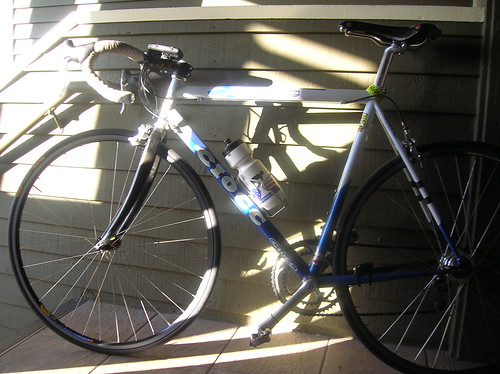
Here's the Ciocc, now with Open Pro rims instead of the Ksyrium SLs. The Ksyriums were decent, but having to worry about breaking some proprietary spoke (that requires a wacky spoke wrench to fix) was never a good feeling.


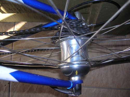
The Powertap Pro+:

On the way down to Lake Washington (I headed to Leschi for a warmup), I saw none other than SIR's very own Jan Heine (I think), doing what looked like a pretty fast interval on a bike with fat tires & fenders, about to dive down that section of Lake Wa Blvd through the Arboretum. I'm sure he's gearing up for that next 7 hour 200k.

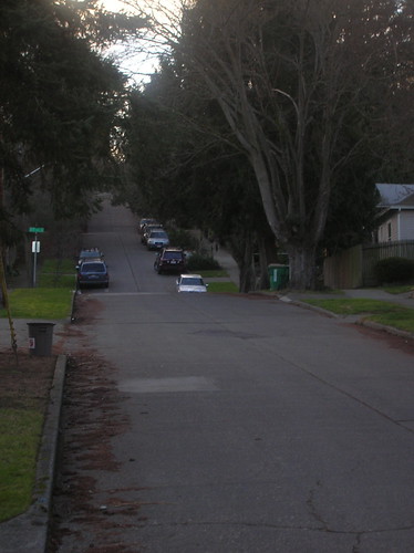
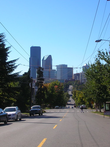
What you're looking at is E. Roy Street facing west - I like how it ramps up by about 5-7% each block. The first section is maybe 8%, then it goes to 13% or so. And then, 20%+.


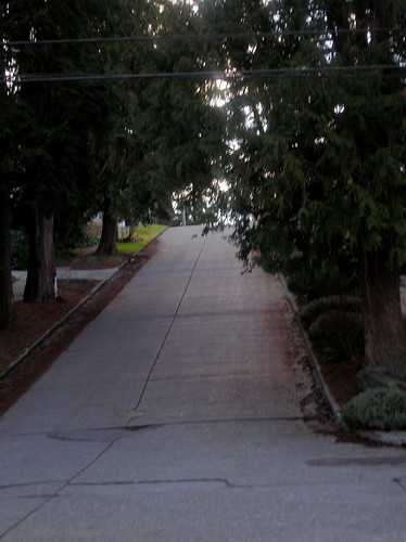
And after two blocks you're here, at the (supposedly) steepest section of paved road in Seattle city limits. WKO+ was saying some sections of this were 23.5%, and I can believe it. Doing this seated, on a 39x25 gear was kind tough. But it was a great way to pump out about 400+ watts for 30 seconds:

After doing Roy once (all the way up to the cobbles), I turned around at the top and went down for a second dose. Going down a 20%+ grade is almost just as interesting as going up.. luckily these are low-traffic streets, but you always wonder when your brakes will give out.. just don't brake too hard, and dont' lean too far forward!

After two repeats of Roy street, I took a right on 23rd Ave and shot down the hill, passing cars at 30 mph - could have sworn I used to hit 35+ on that downhill.. oh well.

Power Stats

For the climb up 10th Ave from Roanoak up to Cap Hill - you can zoom in on certain parts of the ride, and get detailed info on it. For instance, I always thought that hill was steeper than 5%!


Duration: 3:46
Work: 64 kJ
TSS: 7.3 (intensity factor 1.081)
Norm Power: n/a
VI: n/a
Pw:HR: n/a
Pa:HR: n/a
Distance: 0.746 mi
Elevation Gain: 203 ft
Elevation Loss: 8 ft
Grade: 5.0 % (196 ft)
Min Max Avg
Power: 153 605 282 watts
Cadence: 40 83 65 rpm
Speed: 2.4 17.9 11.9 mph
Pace 3:21 24:46 5:04 min/mi
Altitude: 138 333 249 ft
Crank Torque: 174 763 368 lb-in


Entire workout (196 watts):
Duration: 52:57
Work: 656 kJ
TSS: 81.8 (intensity factor 0.963)
Norm Power: 261
VI: 1.26
Pw:HR: n/a
Pa:HR: n/a
Distance: 11.251 mi
Elevation Gain: 1508 ft
Elevation Loss: 1516 ft
Grade: -0.0 % (-8 ft)
Min Max Avg
Power: 0 802 206 watts
Cadence: 15 110 64 rpm
Speed: 0 56.4 13.9 mph
Pace 1:04 0:00 4:18 min/mi
Altitude: 16 405 156 ft
Crank Torque: 0 1744 289 lb-in


Tomorrow, I'll head out for some interavals.. should be interesting.

Tuesday, December 2, 2008

A Little Mountain Tour In The Fog

So it was Sunday, and it was foggy, essentially misty outside. Time to break out the Pacer (w/ full Honjo fenders of course!) and go for a spin.. to my favorite stretch of road in the Seattle area, Cougar Mountain.

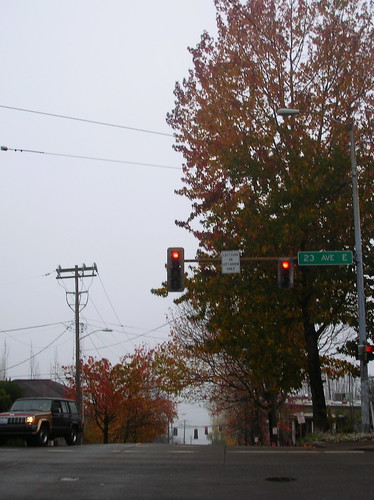
At the start of the ride, heading east on John St, crossing 23rd ave. (Came back up this way as well which was really slippery! I had to sit to keep my rear wheel from spinning)

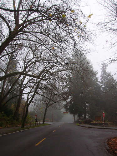
After a screaming descent down Madison (which is almost always slowed by autos), and a quick right on Lake Wa Blvd takes you to one of the best roads in Seattle:

Now heading up to the I-90 trail:

I love this little downhill on Mercer Island:

Now crossing into Bellevue:

Riding through the Mercer Slough area - always a bumpy ride. I kind of hate this section.

Time to climb... but after having always done Cougar Mtn in a clockwise direction, I wanted to try something new. Plus riding up the 54th St side is really slippery on a wet day, like this one. So I took a right up Lakemont Blvd, off of Newport Way: (goes up for a mile or two, with some 10%+ sections)

One of the downsides to going this direction is that it's less scenic than the other way - after 10 minutes of climbing it still looks like:

After going up Cougar Mountain Drive(?), through the fancy housing area, past the school at the false-peak, and the bonus climb (another 15-20 minutes of climbing, and a little descending), I came to this beautiful, but scary hairpin on Cougar Mtn:
(I went around that turn suuuuper carefully!)

After passing through Issaquah, and doing the Tiger Mtn loop, I turned back towards Seattle, via May Valley Road - another nice one:

Now heading west back to Seattle near Factoria, with the Olympic Mountains in the background.

It was a great ride. I think I was the only person out in short sleeves & knickers that day, but my wool baselayer + wool SIR jersey were plenty to keep me warm! (And the Sealskinz gloves were great too). 

OK, so I might have been pushing it a bit with no sleeves - anyone else in denial that Winter is definitely here?


Tuesday, September 16, 2008

City Hills: Madrona, Queen Anne, Capitol Hill

The Pacer is in the shop, getting the new Honjos put on - can't wait to see it in person! Although apparently the Grand Bois 28c won't fit with the fender in the rear.. damn. I can probably at least run 26's on it.

So tonight I took the Ciocc out for a spirited ride, initially to do the Mercer Island Loop. But a few kilometers away from the apt, I realized I'd forgotten a pump! So instead of doing Mercer, I just kept it in the city. Closer to the population of other cyclists, with pumps hopefully!

Ride Description

First, the elevation graph of the route I ended up doing: (max height 439 feet)
From Capitol Hill down to Lake Wa Blvd, right on Madrona Dr (big 1 km+ uphill), follow Union st all the way to Broadway (hilly). I held 16 km/h (10 mph) for the first few minutes going up, but eventually dropped down to 10 km/h (6 mph). The Ciocc climbs well, especially when unloaded & the dynohub taken off!

From there I came back west to Broadway, and bombed down Denny Street over I-5. Probably hit my top speed in the route, 67 km/h there! At that kind of speed in the city, cars start to hold you back. I'd love to do a road race in the city some time, and have that be part of the course!


Then there's Queen Anne, easily the steepest part of the route, heading up to the views of downtown at Kerry Park. Had to take a little diversionary right on a less-steep road on the way up, on which I rode half way up, turned around, and then re-attacked Queen Anne Ave. It's so damn steep!

Then I came down the other side of Queen Anne, and on the way back I held a good 25 km/h heading up the little Dexter hill. Took a left on Denny (crazy traffic) and followed it all the way back to the Hill. Even kept in the 53-tooth ring coming up the steep section next to Whole Foods! Granted, I was grinding at probably 30 RPM, but it was actually a good feeling. I felt like the chain was going to snap before I would.


If the Oregon 600k pans out this weekend, I think I'll be well-prepared! And I felt surprisingly well, given all the climbing on Saturday.


Route Distance: 21.5 km
Rolling Time: 1 hr 2 minutes
Overall Time: +5-10 minutes?
Average Speed: 20.4 km/h (12.6 mph)
Map Link: here

Sunday, September 7, 2008

SiR "Mountain Populaire" 100k

Today was a local event that I've heard about almost as many times as the STP. It was finally time for SiR's 100k Mountain Populaire! This is an annual event put on by SiR's very own Kent Peterson.

Initially I was signed up to ride the HPC, but given that it fell on the same day as the Populaire, I gave away my HPC ticket and set my sights on the Populaire. (Not to mention that riding the HPC would be redundant since I'll be doing that ride (Windy Ridge) as part of our upcoming 600k)

So I set out Sunday morning, eager to do a real first ride on the newly-built Pacer, with its brand new Grand Bois 28's. In summary it was a great ride! And while the Pacer is obviously heavier than the Ciocc, I don't think it held me back at all: I finished in 4:50, in the top 10 of all riders on the course. Nice to know that comfort and speed don't have to be mutually exclusive. It's really the engine that matters most I think.

Left the crib at 7:30 AM, later than I wanted since the ride started ~14 miles away in Issaquah. I had no idea what time it was (watch is broken), or how far I'd gone (haven't hooked up cyclocomp yet), so I wasn't sure if I was going to make it.

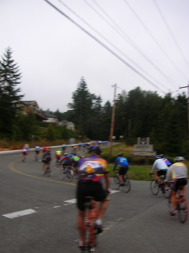
Then about .5 miles from the start, I saw the peloton going the other direction. I was late. Again. So I stopped and got some photos of course!

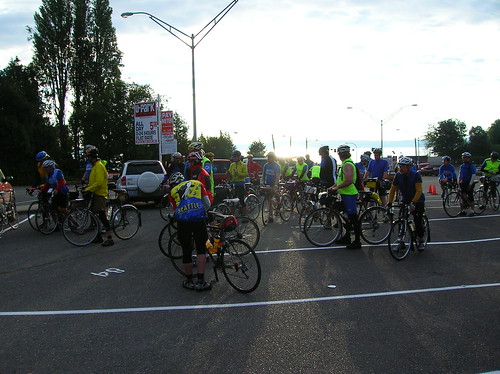
The whole pack. Time to catch up!! (Meaning I never went to the start, so I didn't have a control card, and hence I didn't get an official finisher's pin at the finish)

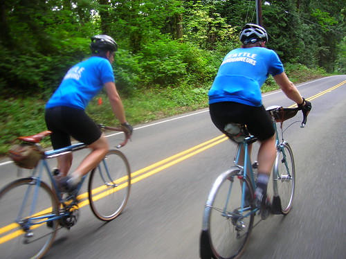
The pack attacks Cougar Mountain. Or was it the other way around?

Another Cougar action shot. On Cougar I moved from the rear of the pack to the front third. Eventually caught up with Jack B, who was holding a strong pace all day.

Now riding with Jack B, his buddy Tom, heading up Tiger Mountain. I'd never done it in this direction (CCW), but it probably a tad easier this way.
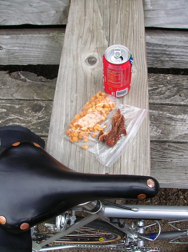
Lunch in Carnation, at Sandy's Espresso. On Tiger Mtn I dropped this very piece of jerky on the road, and Joe P commented that it looked like a piece of wood! Hey if wood had that much salt on it, I'd probably bring it along on rides too.

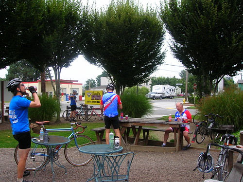
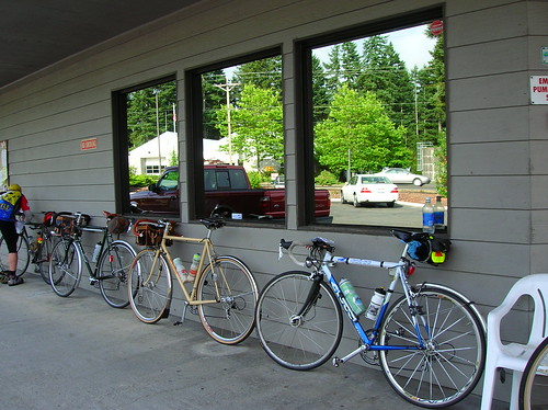
Riders refueling in Carnation.

Now climbing Tolt Hill Road. Ouch. Actually it's not half as bad as Cougar Mountain, but it still took a while. Tom said he did it in his big ring!! No wonder he was so far ahead of us.. Big thanks to Jack & Tom for waiting for me at the bottom.

Grand Bois tires & a Schmidt E6 headlight; essential rando elements.

Finished! Now we're at the brew pub in Issaquah. 

The Pacer, enjoying its first day on the road. And a great day it was!

Now heading back home, in the city. I love riding from the city, to the countryside, and then back.

It was a great ride, and I highly recommend it to anyone that likes to suffer (or excel, as the case may be) on hills!

Ride Stats:
Distance: 14 mi there, 70 mi ride, 14 mi back = 98 miles total
Populaire ride time: 4:50
Maphere

Sunday, August 10, 2008

Seattle to Cougar Mountain, WIth Some Offroad Action!

After watching some Olympic road cycling today, I went for a spin with a goal of hitting up the Cougar Mountain Climb, one of my local favorites. Sunny skies, a littering of clouds, what more can I ask for?


On the way out over I-90/Mercer Island, there was a guy riding on the freeway, going the other direction (this was on the bridge between Mercer Island & Bellevue). After he saw me I think he realized what was going on, and got on to the trail.

At first I was thinking he was a rider finishing some crazy coast to coast tour, and having ridden I-90 for the last 1,000 miles, was oblivious to the bike trail. Instead it was a guy in Dockers shorts, on a hybrid or mountain bike - had probably just gotten on the wrong road in Bellevue that spit him out onto the Interstate. I'm all for riding on big highways, but only in the parts outside of the metro area that you're allowed to do so - otherwise is not a good idea!


Anyway I made it out to the base of Cougar, and had passed a smaller chap on a big mountain bike, who somehow had held on enough not to be completely dropped by the time I started Cougar. After a few minutes of climbing, I look back only to see this little guy (well he was kind of short I think), chugging up the Mountain after me.

We must have been going about the same speed the whole time (10-11 km/h), as when I got to the "top" and was taking the left for the "bonus" climb, I could see him chugging up that last little kick. It's nice to have someone chasing you! Makes for good motivation. For all know the guy was heading home, but in my head he was out to catch me..

After the leg-breaking bonus climb, I ventured into a new area of Cougar: the unpaved part. When you keep going straight at the top, the road becomes gravel/rocks, and I just kept going.


My 25's aren't much for dirt/gravel, but they held out pretty well. I rode on this unpaved road for about .5 km, then ended up at a trail head, and turned around. The small descent from the trailhead (on dirt) was interesting - I haven't ridden with the uneasy feeling of going forwards, yet sliding sideways at the same time, in quite a while! What a feeling! You're out of control, but not enough to make you crash - you just have to plan waaaay ahead when it comes to steering.


The screaming descent down Lakemont (?) was great, and I hit 77 k/h on it (w/ dynohub on). I've done 80 km/h going down that before, I must not have done the aero tuck correctly...


After making my way back to Seattle via the I-90 trail, I took Lake Wa Blvd over to Madison St, then after a left on that, took a right on 29th to begin some more brutal climbing. Usually Dennis & I take Aloha Ave to get back up to Volunteer Park, but this time I decided to take Seattle's steepest incline, weighing in at a whoppiong 22% grade!


Sure, it's only one (small) block long, but with about 60k of work on my legs so far, it looked pretty daunting. Actually it looks more like a wall than anything else! And you get to do a 10% or so block of climbing just to get to the steepest section...


I geared down to 39x27 and let it rip - I ground up the incline, barely eeking out 4-5 km/h, if that. You've got to balance just right on a hill like this: too far forward, and your back wheel will skid. Too far back, and your front wheel will leave the ground! In fact there were a few times that my front wheel poppped up a bit, quite scary.


But in the end I made it to the top, without stopping or walking. The cobbles after this section were a relief, at an easy 5% grade or so.
Ride Stats:
Total Distance: 65 km
Total Rolling Time: 3 hrs 4 minutes
Total Time: 3 hrs 30 minutes
Totals Year to Date: [log]
Distance: 8,184 km (5,085 mi)
Last Month's Total: ~1,800 km (~1,200 miles! My first >1k miles in a month so far)

Wednesday, August 6, 2008

A Ride To Queen Anne's Infamous Inclines

Went for a spin last night, heading down my hill (Capitol) towards another one (Queen Anne). 

The first stretch down Denny is really fun - so fun I can't even look down to see how fast I'm going, dodging potholes & cars as I cross the I-5 overpass, and actually get a green light at the bottom! Passing cars is lots of fun, especially when you're going close to 30 mph!

Here was a shot of Denny close to 5th Ave - yeah it's blurry, but hey I was going fast..

Open Pro wheel shot (blurry was a recurring theme in this photo session):

Goal reached! Kerry Park's great view of downtown & West Seattle. The only part of the picture that really matters is in focus:

Cyclists in Seattle either get used to the hills, or they quit cycling altogether. Or they find ways to avoid them, but that's pretty hard to do around here. I see cyclists of all types climbing the hill close to my house, from fixies to cruisers to roadies.

But one place I never see other cyclists is on Queen Anne Avenue! I know that other people do it, but I can see why most avoid it. Yet I keep coming back for more.. here's a view looking down it, from Highland Drive (I think):

Handlebar shot, with Schmidt E6 shining bright:

When it was all said and done I'd spun out 15.5 kilometers, at an average speed of 22.something km/h. Not very fast, but hey it was hilly, what can I say? 50-something minutes of rolling time, about an hour overall. 

I love this city!

Saturday, July 26, 2008

Tahyua Hills 200k Brevet 2008: Up. Down. Up. Up. Down. Repeat.

After getting a DNQ result in my last 200k, I was dead-set on finishing this one with credit. No speed/time goal in mind, besides doing the ride at something above the randonneurs' minimum of ~9 mph, or 15 km/h.


This route is known for its inclines, and in a similar fashion to the Olympic Peninsula, and the Puget Sound islands (Vashon, Bainbridge, etc) lots of hills is what you get. Not huge, maybe 400 feet at most, but some were quite steep. And as you can see from the elevation profile, there were lots of them!

You can find the map of the route here: [map]

Check out the elevation profile of the route here: [elevation/map]

I heard quotes of 8-9 thousand feet of climbing for this 209km/130 mile brevet. A good warmup for the RAMROD (coming up on Thursday)!

The Ride to the Ride

I made it there with time to spare, as the Ciocc is pretty good at carrying me at ~36-40 km/h (23-25 mph) on the flats, but on the hills it's mostly up to me, and going up Delridge on the way to the ferry dock at 5:30 AM, I took it easy.

The sun was still rising, the air cool. But my wool jersey, and the effort, was plenty to keep me warm.

On the right you can see what Seattle looked like (well, minus the slight blur) from under the Viaduct.


Riders queueing up for the ferry to Southworth:
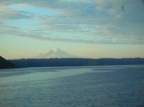
From the ferry, you could see Mt. Rainier:

Southworth to 1st Control

Riders getting ready to roll:

After the pack rolled out at 7:00 AM sharp, the usual filtering of the riders took place. The first 10-20 km were true rolling hills (you could keep your speed over the top of most of them), and Chris, Joby, Robert, and I stayed together, but after a while Joby & I ended up riding with two other riders, at the front of the pack.

I really wasn't planning on trying to do this brevet fast, but the itch was there and I scratched it! My speedometer wasn't working, but I'd guess we cruised at about 40 km/h for a while, the three of us trailing behind a really fast guy on a Litespeed.

But I knew I couldn't hold this pace forever, and planned on taking it easy after the first control. We made it to the gas station at about 8:20 AM or so, 40 km into the ride. The really fast guy spent about four minutes there, and then rolled out. I bet he finished first!

At the first control:

Joby & I bought some water, snacks, etc, and shortly Chris rolled up, followed by Robert. We rolled out together, probably 20-25 minutes after arriving. Probably too long to spend at the first control in a ride, but for this one I wanted to stick with the trio.

To The Next Control

Light rain started coming down, and after a quick stop to put on rain jackets, I was donning my brand-new Rapha "softshell" jacket - glad to put this thing to use, considering I spent lots of dough on it! It worked perfectly, and fits way better than my old jacket; this one doesn't flap in the wind, which I always hated about the old one.

After about 10 minutes of rain, it stopped as quickly as it started. Luckily the jacket is breathable enough that I didn't need to take it off! Another advantage over my old Shower's Pass jacket.

During the next stretch we ended up pacing behind a fast tandem, and tacked on to their paceline. Again I have no idea of our speed, but it was definitely a decent one! None of the climbs were too bad at this point, and after a while the paceline seemed to slow down, so I broke out of it and went up the road.

I knew we were close to the next control so it wouldn't be long before the paceline would catch up eventually. Rode alone for the next few kilometers, and made it to the next control at Kay's(?) Corner, a gravel patch overtaken with a tent, volunteers, and lots of bikes!

The famous SiR support was there, making sandwiches, offering water, mechanical service, the works! Thanks a mil' to everyone who helped out with the ride. Shortly after I got there the tandem's paceline showed up, perfect. Back with the trio.

I spent another 20-25 minutes here at least, eating chips, the falafel wrap I'd brought, chatting, and downing liquids. The word was that the next section was where the hills really were. As Mr. Burns from The Simpsons says, "Excellent."

The Real Hills Begin

500 meters or so after the control, we started going up. And up. And up. And down. Then back up. We caught up to a bunch of riders that had left the control before us, many of them we'd see throughout tbe day.

The roads in this section (Kitsap Nat'l Forest?) were great! Pretty narrow, no center line, but no traffic either. Surrounded by trees, trees, trees. We saw a small deer too!

A pic of Chris rolling through said tiny road:
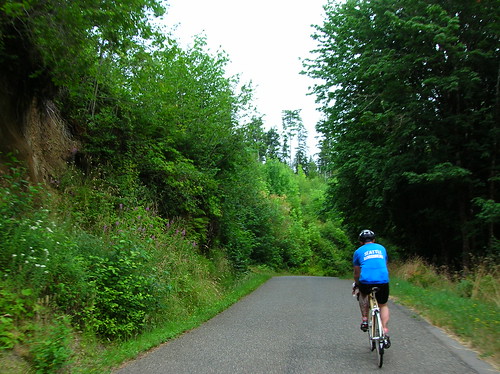
We started pacelining again, I think with the same tandem from before. Somewhere along this section I went off again on my own, passing lots of people. It wasn't that I didn't like riding with everyone I was with, it was that my legs said, "we've got the energy, lets see how far you can go fast(er) for?" OK, let's do it.

So I rode alone for a few kilometers, then one guy that I'd passed caught up and passed me on a climb. It was so easy to "give up" on some of these climbs, and switch down to 39x25 (my lowest gear) and soft-pedal up the incline. I passed him on a big downhill somewhere along the way, and after the right on to Seabeck-Holly(?) Road, more big climbing started. In fact I think we went uphill for about six kilometers or so, but without a cyclocomputer it was hard to be sure. It started steep, and got less so as it went on. But it went on for a while!

Rode alone for the remainder of this portion until the next control.

The Dog

Near the top of the hill, or what seemed like it was about to the be the top, a medium-sized brown dog came sprinting at me, dragging a red leash (rope?) behind it. I guess all the cyclists passing by was too much for it to resist! It came at me from the left, and I was too stunned to do anything but keep on pedaling, hoping that my pace was great than its. It really wanted a piece of my calf, I could just tell.

But in the end I just rode away from it, I'm really glad the scare worked out for me. I heard later that it didn't work out for someone else, and they had their ankle nipped, but nothing too serious.

Seabeck

I was expecting at least an intersection, a stoplight, something to denote a "town" called Seabeck, the next control. But I think Seabeck is really a codename for about four shops (general, massage, pizza, gifts, espresso) that line the waterfront. About 10 riders were already here, enjoying water, ice cream, chips, the good stuff (there was probably someone hiding in the portapotty, snorting some kind of secret Hammer powder, shunning any solid food).

I bought peanuts, Lay's chips, water, and an "Arizona" Green Tea, those drinks are so good. For this ride I'd decided to stay away from sugary things like I used to eat on rides, like Snickers/Payday bars, Cokes, etc. Trying to focus on salty things, at least when it comes to food. And I can say that it worked! No upset stomach, the first time in a while on a long ride.

Before too long Chris showed up, and Joby & Robert weren't too far behind. We sat at a picnic table outside the store and enjoyed being off the bikes, stuffing our faces with something or other.

I spent at least 40 (yes 40!) minutes here, but at this point we had plenty of time in the bank, as 13.5 hours are given to riders to complete this 200k. So there was no rush, no pressure, just a nice day for a great ride with some hardcore cyclists.

Anderson Hill Road, and More Hills

The scenic lead-up to Anderson Hill:
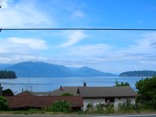
The next big ascent was apparently Anderson Hill Road, which everyone said was the worst climb of them all. We rolled over some scenic roads (above) and finally made the left turn that brought us to our next big one.

This hill felt like 7-10% grade, and went for a km or two. The worst part was the sun beating down on you, with no wind or breeze to cool the skin. That and the fact that my 39x25 wasn't really an easy gear on this hill!

We finally got to the top and stopped for a mini-break on the side of the road. Somewhere along this portion Robert fell behind the three of us, and we never actually saw him again. This section featured some decently long climbs, but nothing steep. We passed a "high-powered rifle" shooting range, which sounded, of course, really loud with each gun clap. I pictured the occupant in the house across the street cringing with each shot, but hopefully they're OK with it! I was glad to be gone from there.

This road seemed to go on forever and ever, and went slightly up as well. Somewhere along the way I swear I saw a motorcyclist shake his head in disgust at me/us, and this was probably the case given what happened to Chris about 30 minutes later: At the intersection just before the next control, we were stopped waiting for the green light. About 30 motorcycles were taking a right, passing us going the other way. Apparently one of them looked Chris in the eye, and then spit a sunflower seed at him! That's a new one.

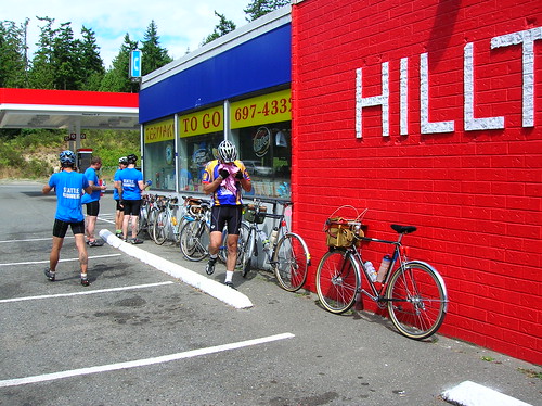
Brevet riders at the last control before the finish - after this, "just" ~30 miles to go!
After surviving some stretches as long as 10km on Highway 3, and a little bit on Highway 16, and even doing a "victory lap" at the roundabout because we missed the correct turn, we finally made it to much nicer roads. Meaning, they were two lanes with less than 10 cars/second passing you by.

I was definitely tired by this point of the ride, but not done. Although close. Had this been more than a 200k I would have taken a long break, but we trudged on.

Climbing "One Mile Hill" I believe - this was taken over the shoulder, while moving:

On the approach to the ferry - now those are rolling hills! Looks even cooler in real life:

I'm cutting out a lot of the rest of the ride, and possibly other tidbits worth mentioning, for the sake of brevity. For instance we passed through Silverdale during their "Whaling Days" festival, which meant parking on the shoulder, and lots of pedestrians crossing the road. And lots of bass coming out of cars/trucks for some reason. But maybe that's always the case out there?

At 5:30 PM or so we rolled into the finish, happy to be done! We and had to wait for about an hour and a half for the next ferry - but luckily the corner store had decent sandwiches (fresh as of two days ago), and soda w/ ice - mmm.
We told war stories from the road, and pondered what happened to Robert. Hope you made it! Sorry we didn't wait for you, I kind of feel bad about that...
Ride Stats
Distance: 209 km + 23 km commute to the ferry = 232 km or 144 miles.
Ride start time: 5 AM
200k time: 7 AM to 5:30 PM or 10.5 hours (for reference the fastest was probably closer to 7 hours!)

Official times will be posted here. A few more photos here.

Saturday, July 5, 2008

July 4th Spin To Snoqualmie Falls, Cougar Mountain

Yesterday I set off with a loose route in mind: Renton, Issaquah, Cougar Mountain, maybe Snoqualmie Falls. I figured it would be about 70 or 80 miles, and if it turned out to be 100, well that would've been OK too!


With the STP next weekend, and the RAMROD a few weeks after that, I wanted to combine distance with climbing - then again, it's hard not to do that around here.

Check out the elevation graph for this route - sort of like a roller coaster: (max elevation is 1,000 ft or ~330 m)
Starting out, I did the familiar Lake Wa Blvd heading south at 1:30 P.M. to the tune of a light headwind. But a headwind I could hold 32 km/h into it. By the time I hit Renton, I was
 averaging 29 km/h - a good start, but I knew the speed wouldn't last.

In Renton I believe 99% of cyclists take one look at the four-lane Highway 900 that heads uphill and think, "I'd never go up there." They're doing the Lake Wa Loop - a great route - but I never, ever, ever see anyone else riding up this hill! Come on folks, it ain't so bad.. (although the shoulder is kind of dirty, covered with rocks & debris)

Highway 900's hill is only 100 meters high, nothing special. But the descent through the thick country woods is well worth the slog through strip-mall-hell! Soon enough you're in the country, enjoying clean-ish air and stunning views.

After getting up and over the Plateau, I took Issaquah-Fall City road east, towards Fall City. After a fast downhill (didn't even touch the brakes!), I took a right and followed Issquah-Fall City Rd for a few more kilos until I hit Fall City. Here's what the stretch before Fall City looks like, awesome:

After spending a little time on Highway 202, I was at Snoqualmie Falls at about 4:39 PM. It was crowded, but there was enough space for me to squeeze in and see the Falls - wow.

I was somewhat dreading the way back, with a little climb up Iss-Fall City Road that was undulating but lasts 5 or 6 km (I think). It wasn't as bad as I thought, although doing Cougar Mountain after about 65 miles was taxing! But I knocked it out in about 25 minutes of ascension.

I tried a new descent coming down it, this time just going straight at the top and following the road all the way down to the stop sign, where I took a right. You go uphill for a few hundred meters, but then it was a BIG downhill - with a signed that warned of a 10% grade up ahead. (Lakemont Blvd?)

I hit 78 km/h (~49 mph) going down that stretch, and was pedaling so fast that my 53x11 wasn't big enough (or rather my RPMs weren't high enough). Damn I love going fast! It's a nice gradual turn at the end, compared to the tight turns going down 54th St/The Zoo climb.

Then it was a slog back up Newport Way all the way from Eastgate, and then the I-90 bike trail, across Mercer Island, and back home via 12th Ave.

Felt strong coming back up Capitol Hill - I definitely feel confident about the upcoming STP! I should be able to do it in less than the 14.5 hours it took last year.

Stats:
Total Distance: 130 km (~80 mi)
Total Time: 1:30 PM to 7:30 PM (6 hours)
Snakes Seen: 1
Flats: 0
Rain drops: 0
Food: 1 Bag of Jerky, two water bottles (ice-cream sandwich & cola at the Falls)