But eventually I got the idea to just ride out to the start of this brevet too. Not since last year had I done Snoqualmie Pass, and I've been itching to see snow on mountains close up for quite a few months. With a day off from work Friday before the brevet, I had plenty of time to get there before the brevet start at 5 AM on Saturday in Ephrata.
So this wasn't a last minute decision at all - I'd been planning to ride out for quite some time when the day came. The initial plan was to camp out in Ephrata, but I think that might have been biting off more than I could chew. I went as far as to pack up a sleeping bag, mat, and bivvy in a Carradice "Junior" bag, and somehow all that fit in there. Commuted with the extra four pounds on the rear of the Pacer, but in the end I just rented a hotel room. Maybe I'll camp out next year, or on the upcoming 600k.
So all I needed was a little bit of extra energy, lots of patience, and a bike, to get myself out there. And once I found a nice alternate route from Cle Elum to Vantage (skipping I-90 on that section) the deal was sealed. You can see my route to the ride on Google Maps.
While I've done quite a few passes last year, I've never done one without being on a brevet or official ride. Riding into the mountains by yourself feels like you're taking on the whole world. Yes it's a little daunting, but when things get scary you know you're at least breaking new ground.
Short version
I did about 155 miles on Friday, riding from North Bend to Ephrata. Then on Saturday I did about 250 miles (409km), riding from Ephrata to Twisp-area, to Omak, and back to Ephrata. Definitely the most riding I've ever done over a two day span. (About 400 miles in all, or 640km)
Read on for the long version.
Now on I-90. Traffic was light, but loud. It was chilly, but not too bad. Once you get on the road it doesn't seem as scary as when you think about it. But there were a lot more (tiny) rocks on the shoulder than I'd remembered.

The sun had been rising for a while, but was hidden behind the mountains for the first hour or so of the ride. Unfortunately it disappears behind the mountains soon after this stretch, until you hit the summit. From last year's 400k over this pass I'd remembered to pack cold weather clothes, even if it's going to be a hot day. (A road sign said it was 34F near the top)
I was sporting thick wool socks, booties, wool knickers, two base layers, one wool, long sleeve wool SiR jersey, Ibex wool vest, and long-fingered wool gloves, and a hat.
The grades were gentle for the most part - my Garmin unit showed somewhere between 0% and 6% grade. Last year I was riding an unloaded Ciocc on this pass, and was able to do just about all of it in the big ring. Not so much on the Pacer, I was chugging along at 16 km/h for a good chunk of this ascent.
Snoqualmie Pass summit - 3,022 feet. It's not really a hard climb to get up here, but you certainly notice it.
View near Snoqualmie Pass summit:
I-90.
The Pacer at Keechelus Lake on I-90. It felt a lot colder in this section, and my ears and hands were freezing. I added wool arm warmers, skull cap, and thicker gloves to block the chill. Felt great after that. Somehow last year I pushed through here in a short sleeve jersey, arm warmers, and short fingered gloves.
Near Cle Elum my alternate route put me on Bullfrog Road, an excellent back road. I didn't know it would be this nice from looking at the map, but I was hoping for scenes like this instead of the drab views on I-90 from Cle Elum to Vantage. I was in luck.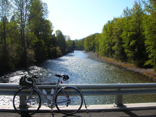
Cle Elum - quaint: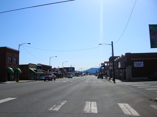
Breakfast in Cle Elum at the Bakery. So good.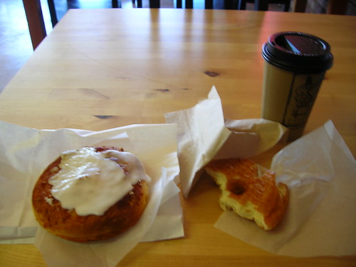
After Cle Elum I took Higway 10 towards Ellensburg. From the map it seemed like there wasn't anything between these two towns, so I stocked up on water & food. I brought about 8 packs of Clif Bar Shot Blox, which are my new favorite ride snack.
I was definitely impressed with the views offered on Highway 10 on the way to Ellensburg:

I kept saying to myself "it just doesn't get better than this." But that's the great thing about finding new roads, there's always something more impressive, or at least different, around the next bend.
River view on the way to Ellensburg.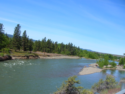
Gardenburger in Ellensburg. The fries were pretty good here too. (At one of the two "U-Tote-Em" burger places in town):
Pacer at burger joint in Ellensburg:
Now on Vantage Highway, on the way to Vantage. No stores for 60km, which isn't too big a deal, but you need to be prepared. I had a third water bottle just in case. It's a foldable thing used for camping, which works nice since space in my luggage was limited. Every square inch counts. So when it's not in use, it's tiny, but unfolds to hold about 24oz. of liquid.
Because you can't have too much water for a long stretch like this:

Rocks and road on the way to Vantage - traffic was really light along this route, and there were very few big rigs. Quite the opposite of I-90:
Pacer with Mt. Rainier in the background. This was near the Wild Horse Wind Farm. We drove through here on the way back to Seattle on Sunday, and went to the visitor's station - a 3-mile climb up to the top, getting close to the huge turbines (Diameter of the rotors is apparently bigger than the wingspan of a 747). That visitor's center would make for a great control on a brevet..
Vantage to Ephrata
In Vantage I upped on water and continued on. I knew that the most challenging part of the whole ride was coming up. Not a climb, but the Columbia River bridge on I-90 at Vantage. Somehow, while WSDOT does a great job of considering cyclists on I-90, this bridge doesn't even have room to walk across it.
Approaching the bridge, the shoulder just disappears. I stopped to wait for a gap in traffic, but there weren't really any gaps. Just had to go for it if I wanted to continue..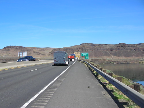
So I went for it. I tried to hug the rail, staying as far right as possible and just trying to stay in a straight line. The first truck that encountered me, a smaller white moving truck, gave me a nice honk. Did I mention this is an uphill grade here? It was going to be a long crossing, even if it's only 200 meters long..
I'd turned on all my rear lights, and put my reflective gear back on just to be safe(r) on this crossing. For the first half, things seemed to be working out. Cars and trucks were going around - I mean there are two lanes to choose from, after all..
But then, seemingly out of nowhere, I was buzzed by an 18-wheeler, traveling easily at 70 mph. The damn thing passed with what seemed like inches, but it's hard to tell when they're going that fast. I was lucky not to be sucked under its wheels..
I was both shocked with disbelief and livid with anger that this truck had seemingly decided to give me a scare - that it plain just didn't see me. I realized exactly how close I'd just come to getting squished - I could have died on that fucking bridge.. but there wasn't much time to ponder this event, I was still only about half-way over it, but the rest of the crossing was uneventful. When I got to the other side I had to stop and take a breather, and reflect on how much I hated that bridge crossing.
(Side note about the crossing: Was talking to Peter Beeson after the ride, who has done the Cannonball ride that does this same bridge. He said the trick is to take the lane, forcing traffic to go around you, instead of giving them space to squeeze by. Sounds counter-intuitive, but this is the case in many traffic situations and I think he's right.)
I wish I'd been able to see what trucking company it was, all I remember was some red on it. Oh, if I could call their "How's my driving?" number and give them a piece of my mind..
The Pacer at the scenic overlook just off I-90. I still can't believe I made it across that thing alive.
One of the gazillions of semi's I encountered along the way. Either you get used to them, or they'd drive you crazy. But I was only on I-90 for about an hour from Vantage to the Ephrata exit, so I didn't have to spend too much time with them.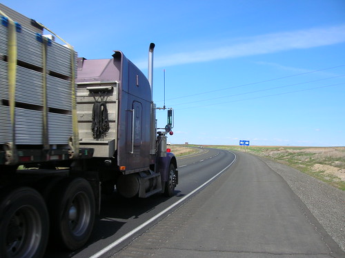
Highway 28 to Ephrata. While the view was OK here, I hated that the road was just straight with no surprises around corners. And the shoulder had cracks every ten feet or so, for about 20 miles. Bu-bump, bu-bump, bu-bump..
Ephrata!
At about 5:30 PM - 12 hours after starting - I rolled into Ephrata. Hooray! I didn't feel too tired, but I was hungry and a little sunburned. I'd put on sun block but had missed a few spots. After checking in I was really happy to have a shower, air conditioner, and all these things I would have missed had I been camping.
A nice lay-down dinner in Ephrata - I ate just about the whole pizza, and saved a few slices for breakfast.
SIR 400k brevet start in Ephrata
At 4:15 the next day I rose to ride again. At about 5 AM the pack of about 50 riders was ready to roll:
After the usual pre-ride notes, we hit the road. A left out of town and we were quickly on desolate roads; the views reminded me of that OR 600k last year.
Even though I'd ridden out the day before, I didn't feel that much different than a usual brevet start. Meaning, I felt just as groggy as usual at 5 AM. But I was happy to be on the road and feeling strong.
The road turned up, and the pack thinned out. Kole was certainly off the front, I don't think I ever actually saw him. (He finished in about 17 hours!) Joe P. & I joined up, and rode with about 6 other people in a nice double paceline for a little while. The roads seemed empty except for bikes, and the sun was just coming up. It was going to be a long, but great, day.
Before too long we came upon this. A road of loose sand, gravel, and rocks. A straight gravel road would have been easier to ride on. (This was presumably paved a week ago when they did the pre-ride)
You can see the tracks of riders looking for a good line to ride on. You'd find something that seemed firm, then plow into a big patch of untouched dirt, or a huge rock. I heard a few people walked it, and I'm sure more than a few took a spill on this - I had to walk one uphill section, but walking four miles sounded worse than struggling at (what must have been) 5 mph or so.
But on the plus side, it had great views!
We finally made it off that hellish stretch and took a left on Highway 2. Somehow I didn't get a flat on it. Eamon Stanley joined Joe & I for the short ride to Farmer, where Mark & Bob were eagerly awaiting with coffee, muffins, and jokes.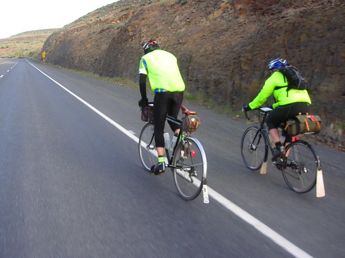
At the control in Farmer. Mark joked to "look out for the gravel" as we approached. Heh.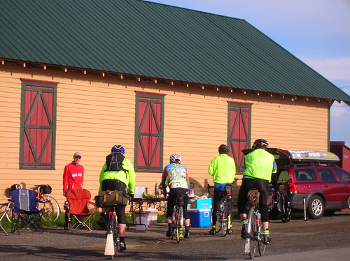
Back on the road, heading into what seemed to be an abandoned land. Farms appeared every few miles or so, but besides them there wasn't a lot going on. I thought it was a great way to spend a few hours, for sure:
The views were somewhat dynamic, even if it was all fields for now: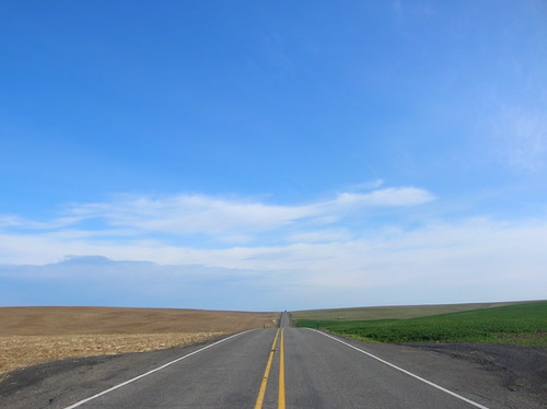
I rode alone for most of this stretch, until I stopped to take off layers and two riders caught up. I think one of them was Dave, the other Joe, but I can't remember. We rode together for a little while, but as the road started to turn up I stayed in the big ring (oddly feeling actually strong) just about all the way up.
I didn't realize it, but we were climbing a pass! Soon after the left on to McNeil canyon road we were at the summit. McNeil Pass - 3100 feet. Higher than Snoqualmie Pass! From the elevation profile of the ride and how it looked, we came up the easy way. It barely felt like a big climb. The descent was great! Saw a few locals chugging up the other side of the pass, one with a Ramrod jersey on.
I kept thinking the riders behing me would catch up, which was a good way to keep the pace up. (I wasn't using a cyclo-computer at this point since the Garmin had long ago run out of juice)
Turned on to Highway 97 and kept chugging along, even taking off my booties while riding, since I didn't want to stop at all. Just wanted to make good time and not waste any.
Highway 97, heading towards Pateros:
The Pateros control. It felt good to have a few slices of pizza here and refill on water. I filled up the third bottle just in case the next stretch took longer than expected.
On the way out of this control we were held up by a parade of bikers, complete with "corkers" holding traffic at bay. Having done more than a few Critical Mass rides, I couldn't really complain (some locals did). See the video of the parade here.
Highway 153 towards Twisp:
More great views: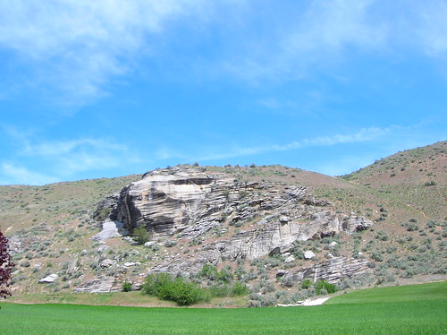
With old buildings along the way too. But when you see those "Pass With Care" signs you can guess that there were probably a few head-on collisions at this very spot. Spooky.
At the control at the turn on to Highway 20, I had a great PB&J sandwich made by a volunteer (didn't get his name). Thanks! Also got more water, and generally enjoyed being off the bike.
When I got to the control there were 20 or so riders there, with bikes strewn about. A few, including mine were leaning against some mail boxes. A local drove up to check her mail, and I apologized for the bike that was in front of th mail box, although it wasn't even blocking her from opening the door. Her response to my overly-generous apology was "Typical."
That's all she said, and stomped off with her mail. Uhh, Ok. I guess she meant typical cyclists not getting in her way and generally not causing problems? You're welcome, I guess. Next time I just won't say anything I suppose.
This stretch seemed to hate bicycles in general. On the way up Loup Loup Pass, a few other riders & I were honked at by passing cars (e.g. one honk per rider), and then a guy in a pickup flipped us off going the other way. They must have had a rowdy gang of randos come through her and beat people up or something, because for some stupid reason they hated us. A lot. Whatever.
At the top of Loup Loup - 4,020 ft - the grades weren't bad going up, and if I was on the unloaded Ciocc I probably could have been in the big ring the whole way up. But in was in the small ring, just glad to be moving, on the Pacer.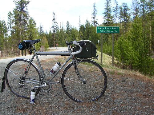
On the way down Loup Loup (I think):
The way down was nice, and there wasn't a big headwinds like there are sometimes around here in the passes.
I was trying to catch a rider up ahead, if for nothing else just to make things interesting. When you're going that fast, it comes down to how fast can you spin?
I eventually caught the rider but then stopped minutes later for a photo op. I guess I was making up for lost time by going fast previous to this.
The descent went on, and on, and then turned into a 1/2-mile steep ascent, that was interesting. Once again, it seemed like we went up the "easy" side of the pass, but maybe it always seems like that.
Sounds like they do this pass the other direction on the Cascade 1200, so there's always an excuse to get out there again.
A Pioneer Museum in Okanogan:
Strange architecture/design in Okanogan - a lot of the town's businesses were surely struggling, and many were closed. That little town is hurting.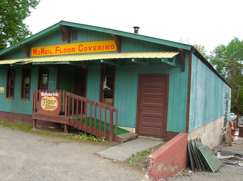
We passed through the saddening Okanogan and then were soon in Omak, which seemed to be doing a little better. I got off track here and added a few bonus km's, what else is new. Back on track I found the Conoco control and enjoyed some cheese sticks and lots more water.
Joe & I rolled out of this control together, having "stocked up" just like the cue sheet warned us to do. Mark said he'd be on this stretch, since it was 60(?) miles with no service.
The view of Omak Lake from Columbia River Road heading away from Omak:

 There were a bunch of big black beetles crossing the road, and Joe suggested I try to get a close-up of one of them.
The next one we saw happened to be sticking it's butt in the air, maybe trying to dig?
I thought about dropping it in the dirt, but I figured I should let natural selection do its thing instead.
The "secret" control on this desolate stretch before Electric City, which was still 30 miles away. I (stupidly) tried to DNF here, but not because of any physical ailment. I was just tired of being on the road I guess, and asked Mark if they had room in the car. The thought of being carted around in a car full of food sounded more than tempting.
But they didn't have room, so the only option was to carry on. I'm soooo glad this was the case, as in the end it would have been a pointless DNF, just out of mental lazyness.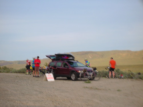
A Cup-O-Noodle really hit the spot here:
This was at about 7:30, and it was getting dark soon. Before I left this control I threw my reflective gear back on, and flipped on the dynohub. Joe had left minutes earlier, so I was trying to catch him. This stretch of road was more of the same beauty we'd been seeing all day, but it was slowly being wiped away by darkness.
There was a two-mile climb, at roughly 10%, coming up to Nespellum(?) and Highway 155(?). I made it up the climb without dying and still felt decently strong, although I hadn't caught Joe yet.
At the turn on to the highway it was officially night time, and I was alone. The party-drivers were out in full force, honking at bikes, yelling, etc. I feel guilty for thinking this, but at the time I thought, "don't you have a head-on collision to cause right now?"
I think I was generally grumpy from being on the road so long, and energy levels were getting lower. The Shot Blox were still good, but I was definitely tired of the Nuun tablets in the water I'd been using.
I was also kind of hating riding at night, not being able to see much beyond the road in front of me, and still having "only 50 miles" to go. When speeds are approaching 12 mph average overall, that sounds like a long way at 9 PM.
After what seemed like hours of riding through the dark tunnel, I made it to the Coulee Dam area and finally caught up to Joe & another rider. We were soon at the Electric City control, where I enjoyed potato-cream soup, water, and chips. Thanks to Shane (I think) for the soup, it really hit the spot.
Joe had left this control before me, which makes sense because I normally end up spending too much time off the bike on these long rides. I was on a mission to catch him, and had a new-found source of energy. I have no idea what speed I was doing, but it felt like it was at least over 15 mph (25 km/h), which is faster than what I usually do at night or at the end of a long ride.
I could see Joe & a few other riders' lights in the distance, and it gave me a "rabbit" to chase. When I finally caught them, I decided I wanted to finish this thing as soon as possible, and just kept going. Before too long I couldn't see their lights behind me, and knew I was making good time.
The next stretch was very desolate, but the stars were out in full force. I of course had to stop a few times just to remember what the Milky Way actually looks like. After the turn on to Highway 17, we were on the home stretch and it seemed to be mostly downhill.
Without a cyclo-computer, I had only the mile markers and cue sheet to keep track of how far to go. I was glad to be within 20 miles of the finish. At about 10 miles from the finish I passed a rider sitting under a street light next to his bike, looking very still.
I circled back and asked, "You OK?" which apparently woke him up - he was doing that crazy thing randos do called sleeping on the side of the road. Said he was waiting for someone to come along, that he felt too tired to ride alone. Sounds good to me, I was actually getting tired of riding alone too.
I think his name was Will, can't remember. Another rider, Noel, joined up with us and the three of us cruised into Ephrata, 22-ish hours after starting. Woo hoo! Vincent and a few other faster riders were in the finishing hotel room, and gave us a hearty applause upon entering. What a great group of people!
Another brevet in the bank, and one step closer to Super Randonneur for this year. During this ride I thought about how I probably wasn't going to do the 600k coming up, since I learned how much I hate night riding. But of course, after about 24 hours the "randonesia" sets in, and the dark memories give light to grand stories and fond figments of imagination. You bet I'll be at the 600!
Huge thanks to the organizers of this great ride, and all the volunteers. It was a wonderful journey.


11 comments:
Amazing ride. You are f'n crazy. I love it.
You are starting (and finishing) the 600k with us. Like it or not.
Fantastic report. I'm so glad to have shared so much of the ride with you. I never spent so much time on a bike telling myself how stupid I am, but I'm already thinking about the next ride.
I love the photos as usual. That beetle shot is a keeper.
See you at the 600.
Robert: Having a rando tell you you're crazy is quite the accomplishment! Thanks, man.
I'll definitely be starting that 600k with you guys (well, if I can make it there on time), but I can't promise anything about the finish. We'll have to see how it plays out.
Joe: Thanks a ton for riding with me and keeping me entertained for hours on end. It would have been a way boring ride without you!
Yeah it's funny how "rando-nesia" works; from the point I wanted to DNF onwards (the last 80 miles or so I think) all I could think was how I was never riding at night again, and definitely not doing the 600k coming up in a few weeks.
But just over 24 hours later a 600km ride doesn't sound that bad after all! Good thing we forget about the lows, or I don't think anyone would ever earn the Super Randonneur award.
See you guys soon.
Sorry I missed out on this one, it sounds like it was pretty awesome!
I was out on my own insanity that day: Tour de Cure century ride, on my fixed gear. I forgot how easy it is to ride when there's big signs, DH arrows on the road, and support stations every 15 miles.
Great pix, and a great writeup as always.
Hey, Matt, thanks for circling back and waking me up. I figured that once I started seeing little-bitty rabbits with little flashlights in the road it was time to get some shuteye. Thanks to you and Noel for keeping me awake those last few miles, and thanks for sharing your blog. See you at the 600!
— What an amazing ride, thanx for documenting it so well!
: )
Very good write up-you articulated a lot of the same things I was thinking. Randonesia-that sums it up perfectly.
Nice post - enjoyed it.
Not being a long distance rider - always amazed at the distances you guys pull off.
Why does leaving any urban area increase the idiot driver percentage? Glad it didn't ruin the trip.
Looking forward to the next post.
Are you guys allowed to ride on interstates out west? (Noticing the I-90 pic.) All of our interstates have big "No Bicycle" signs on the on-ramps. Though, our drivers are even less tolerant of cyclists than out west, so I dont know if I'd want to try even if we were allowed. Some guy was hit and kiled last year on one of our epic rides (TOSRV) when he was off route on four laned a STATE route... (and the driver, after hit-skipping, was let off with a minimal penalty... her trial just ended this past month).
In Washington there are some sections of the Interstates/highways closed to bikes, but they are mostly in the metro areas. Here is a page describing which roads/sections are closed to bikes: link.
I-90 in particular is open to bicycles east of Issaquah at the Front St exit.
I just sent an e-mail to the bicycle coordinator for WSDOT about this bridge crossing, I'm interested to see what they suggest bicycles do there.
Riding on interstates isn't for everyone, that's for sure. And whether or not it's a good idea is a whole other question. But out here some of these big roads are the only way to get into the mountains. And I love riding passes!
I love riding passes too, though I dont do the mileage you do (but live vicariously through your blog). The most miles I've ever done in one day is 110. I generally do 5-6 centuries a year... I used to live in Colorado so I got to do more of that wonderful pass riding. (I love long climbs... I just get quick steep ones out here in Ohio).
Anyway, now that I think about it, I think sections of I-70 in Colorado through the mountains were open to cyclists. I just wasnt as much of a cyclist then as I am now. I might be willing to try it if the berm were big enough.
Thanks for the info! I might come out that way some time to ride... Your pictures are BEAUTIFUL.
Post a Comment