I didn't sleep too well before the start of this year's Ramrod, but that's usually the case for me and big rides. The combination of having to get up early (when I'm used to going to sleep late), and of course nervous jitters kept me awake.
Still, when the alarm went off at 1 AM I got up and prepared for a big day in the saddle. I could think of lots of excuses reasons why I shouldn't do the ride: the fact that I didn't lay down until 10 so I had less than three hours of sleep, or that there was a 20% chance of thunderstorms near Elbe and I couldn't find my rear fender, or that record temperatures were forecast, and that I just got a new stem (2 cm longer) and hadn't done more than 30 miles with that setup. None of these things could really stop me from doing the ride as planned, which meant riding to the start from Capitol Hill just like last year.
I had many generous offers of rides to and from the start, but the goal was to stick it out. After all if I plan on finishing that big 600k (aka "Ramrod++") this year stuff like this can even be chalked up to practice, believe it or not. Randonneurs really know how to take a nice idea like Ramrod and really stretch it out to its limits and beyond.. which is not to say that Ramrod is an easy ride - for me anything over 80 or so miles is a long haul, so this wasn't a walk in the park for me by any means.
In prep for the ride I'd forgotten to buy a good breakfast for the day before, and stuff to make caprese sandwiches. So the plan was to just have coffee and eat some Clif Shot Blox on the 60km/40mi trip to the start of the ride in Enumclaw.
Ciocc on 12th & Jackson in Seattle at about 2 AM:
Since I was starting an hour earlier than last year, the whole ride down to the 'Claw was dark this time around. But since I'd converted the Ciocc to an LD bike for the day, it was equipped with the dynohub & Schmidt E6 halogen light. That light emits a beam that's about 10 feet wide and about as long as you want it to be. The light provides the confidence I needed to roll through total darkness on some of the stretches of Highway 169 through Black Diamond, Maple Valley, and finally to the start of the ride in Enumclaw.
Now in Enumclaw at 4:30 AM or so at the intersection of Highway 169 & Griffin Ave. Making perfect time as it officially started at 5 AM:

The ride start at the highschool in Enumclaw:

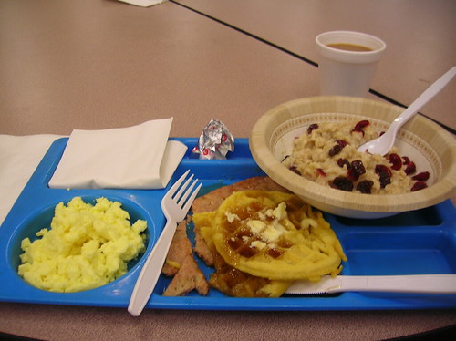
Breakfast! So worth the $10 and 40 mile ride:
Soon it was almost 5 AM and time to line up for the start.
Saw Joe P. from SiR at the beginning, as well as my friend Jesse. After a few minutes of antsy waiting we rolled out. It was still dark and my E6 light seemed brighter than most others' lights out there. I guess you can say randos have extreme lighting to match our rides..
Compared to last year, when I didn't start until 6:30 AM and did this part of the route solo, I was flying. Pacelines were cruising at 40 km/h (~25 mph) and while I wanted to keep the HR down to about 140-150 bpm, it was pretty easy to sit on the back of some of these at 160 bpm or so. I took a pull in one line and just about blew up when we turned into a headwind and I was still trying to hold 40 km/h.. I'm pretty sure that's when my HR peaked at 185 bpm. It was time to back off so I let them go and cruised solo a little.
On the way to Eatonville I hear "On your left - hey Matt!" as Brian O. from Seattle Rando came flying by in another 40 km/h paceline. It was a huge one, with maybe 30-40 people on it and nobody at the back taking pulls - this shot was the best I could do at 40 km/h:

Before too long we arrived in Eatonville, though I'd let the paceline go on the uphill. I was riding by my heart rate and when the little climb came I had to let them go or risk wasting more energy than necessary.
Looking at the ride photos I was somehow the 36th rider (out of 765 photos, not sure how many riders actually came out), landing on Page 2. Last year I was on the very last page since I started so late! It's weird how you can't tell where you are in the group, I thought I was somewhere in the middle since I felt like I was only being passed by people.
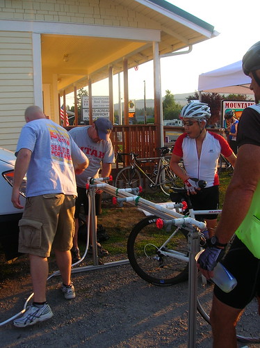
When we got to Eatonville they were still setting up the water supply - guess we were a bit early? Huge thanks to all the volunteers along the way - they really do a lot to help out the riders along the way:
The plan was to keep the stops short as possible, as practice for doing faster brevets, so I rolled out after filling up the water bottles. I've found it isn't so much rolling speed that holds me back on rides but the time spent off the bike or stopped. Brevets aren't races, but on the longer ones the faster you go the more time you have for sleep, which is of course precious on rides like that.
After Eatonville the riders seem to spread out more, and I rode almost solo from here to Packwood. It was clear out, but not as hot as I'd expected. There was plenty of shade for good stretches of the route which helped a lot. I was expecting to be baking on the tarmac but things were going well. And the rain forecast was totally off, as I was hoping, so it was smooth sailing.
Lake Alder near Elbe, Wa on Highway 7:

The township of Elbe - with the "Hobo Inn" on the right - last year I stopped here for water and food, but this year bringing a third water bottle and more food allowed me to continue on:

The tip of "The Mountain" was visible - having started north of it we were now roughly west of it:

Rolling to Ashford on rolling hills:

Food stop near Park Entrance - there was rider who said he went down on the railroad tracks a few miles back. Shane from SiR and others were helping him patch up the wounds and continue on. When you're doing a ride like this, where you've probably been planning it for a while, it will take more than road rash to stop you:

Heading down a long road - we were warned of an "incident" up ahead but at the bottom there was just a police cruiser and I saw the officer climbing back up over the railing of a bridge so I'm not sure what was going on there:

A bagel on the go - my other strategy for saving time was to eat on the go instead of standing around to do so:

Matt, a blog reader, and friend on Skate Creek Road - I was surprised at the number of people along the way that knew me or of me from reading the blog - it really is a small world out there.

There were some gravel/rock patches on this road, as we'd been warned about. Though they said to bring lights for the shadows my E6 didn't illuminate much, so after the climb I slowed down for a manageable and safe descent. A bunch of riders blew past me on the way down, but I was scared of the gravel patches I'd heard about.
Sure enough one came up and I saw a rider ahead of me fishtailing a bit in the patch - so I slowed down to what seemed safe (probably 20 km/h or 12 mph) and went through the patch in the straightest line possible. But soon I saw a pile of what looked like loose & deep gravel. As I hit my front wheel gave out a bit, and I had that uneasy feeling of being out of control of the bike. I was really happy, and lucky, to make it out of that one unscathed.
Nice little view on the way to Packwood - nothing like the stunning shots from the Paradise climb, which was blocked this year for us, but still beats the usual scenes I see in King County:

The Ciocc in Packwood at about 10:30 AM:
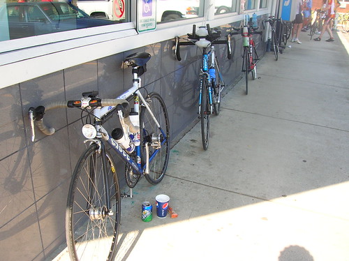
At the gas station in Packwod - the one Robert & I sat outside for hours once - I filled up on a Sprite & what they deemed an "egg roll." I'm not sure of what was in it but it was a nice change from the Shot Blox I'd been eating up to now. I sat down for a few minutes to eat, then put on sunscreen, and rolled out with Joe P, another randonneur. Joe just did a 1000k recently, the Portland to Glacier ride - just goes to show no matter how far you ride, there's always someone out there who can ride further. I've yet to do a 1,000k but one of these days I hope to.
Joe on Highway 12 - and the sign is spot on - "Mountain Pass Ahead":

At the turn on to Highway 123 off of Highway 12, they actually had a State Patrol trooper in the road allowing bikes to freely make a left across the four lanes. Plus we were going uphill and traffic is coming downhill around a blind curve. They had more water here, and Joe pulled off for water, where I decided to risk it and push on to the Deli Stop, just after the Cayuse climb. When I saw the "30 miles to next food stop" sign I thought twice about it, but decided my two full water bottles and Shot Blox were enough (I brought about 8 packs of Blox with me, thanks to Lloyd at Velo Bikeshop who helped me out).
The very start of Cayuse - not that steep:

The road slowly tips up and soon we were at the Park Entrance, where the 2-3% grade & rolling hills turns into a steady 5-6-7% grade for a few miles until the top.

Still shooting for about 140-150 bpm (195 max) I settled into a speed that seemed to hover around 10 km/h. When I did this pass on a 600k once, it seemed to be the slowest slog ever and I hovered at 5-8 km/h. Granted, that was on an old Miyata and after 300 miles..
Anyway I felt pretty good up the climb, and had a few riders up ahead to pace on. It wasn't that I was chasing them, but trying to keep the gap about the same. Of course single riders would blast by me now and then, but I just stayed put and let them go.
It wasn't too hot yet, even though it was 11 AM or so - and last year I was just about overheating on this section. I was wearing a wool jersey last year and I think that made the difference. Plus this year I was pacing more than usual, trying to keep things level so I could finish strong.
Nice greenery heading up Cayuse:

Rainier view on Cayuse:

A nice view of the tip of Rainier:

There was a water stop where I filled up a bottle, know that even just a few miles to go on a pass can take a while. The tunnel on Cayuse - "only" three miles to go!

Nice view near the top of Cayuse - it was a perfect day for a jaunt around The Mountain:
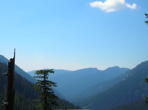
Cayuse near the top - I've always wanted to stop and see what it looks like from the edge, but I guess I'm always too excited to be close to the top of the pass.
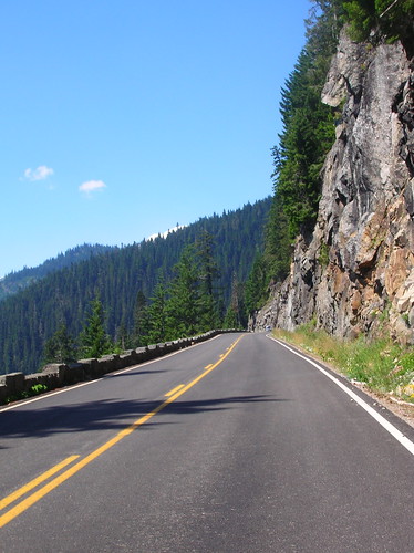
The top of Cayuse - 4765 ft above sea level - it was nice to be done with climbing for now, get some more water, and get ready for a speedy descent down the other side.

In the official ride photos on the way down (with Rainier in the background) I was 128th or so - no wonder it felt like I was getting passed a lot, almost 100 riders had traded spots with me since the last photo. Not that it matters since this wasn't a race, but I like to know where I slot in just the same.
Even though I like my new stem, which is 2 cm longer than the old one, I couldn't quite get comfortable in the aero tuck for very long. But it was still fun to spin it up to 120-130 rpm and accelerate while going 60 km/h..
Finally I hit the deli stop, just before the climb up to Crystal Mountain. Huge thanks to all the volunteers that worked here!

Lunch in the shade:

Dirt buildup on the arms - my legs were covered in dirt as well:

Now time to head up to Crystal Mountain - I heard some saying this climb was too bumpy, and that the descent wasn't fun enough. Or that it was too hot to do it (it was starting to heat up now at 1 PM). But I wanted to complete the whole ride as set out by the organizers, just to say I did.

The climb up was pretty uneventful, and the scenery was OK but nothing special. Maybe I've been spoiled by all the routes provided by Seattle Rando, but it definitely wasn't worth doing if it wasn't part of the route. Still, it was a challenge and I wanted to complete it.
By this point I felt a little weaker than I would have liked, and was looking forward to another snack at the deli stop once I got to the bottom of this climb. Keeping my extra mileage ahead of me after the ride in mind, I was happy to keep about 10 km/h up this six mile climb. Sure enough, it took about an hour to get up there.
On the way up a few riders had just passed me, and I chased (only a 1 km/h acceleration, but that makes a difference over an hour) a little to keep the gap constant. Then a rider came up beside us and passed up like we were standing still. Not standing or mashing, this rider was spinning at a comfortable cadence and was obviously stronger than us.
For some reason one of the riders ahead of me poked at his buddy: "You gonna just sit there like that and let that happen?!" They accelerated slightly, one faster than the other, but the rider that had passed us ignored the comments and kept on spinning, clearly dropping us like a lead weight.
Not sure why it bothered them that a woman was passing them up the climb - even as a "joke", double standards aren't funny. There are those that will always try to push old, dead, and useless ideas, and judging from her speed I'm guessing she had to hear a lot of it on this ride.
The top of Crystal. Not a whole lot going on besides hot pavement:

On the way down there were some pot holes, but I could see them coming and the descent was still pretty fun. At one point I even sprinted on the downhill, going from about 60 km/h to 66 km/h or so. Good spinning practice for the races.
Upon return to the deli stop I found that many riders had since shown up. The back of the line you see there stretches all the way up to the tents where the food was served.. so much for my 2nd snack unless I wanted to wait for a while. So I pressed on.

Highway 410 heading west to Enumclaw - a now familiar road since I've done this on quite a few rides and brevets.
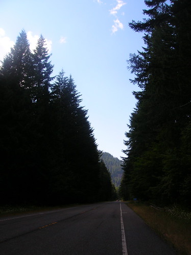
I rolled out solo, and felt decently strong, though I was never going as fast as I wanted. On what were measured as only 2-3% grades by the Garmin 705 I was only pushing 16-20 km/h, e.g. not impressing anyone. Of course eventually a paceline passed by, and I hopped on the back. Speeding up the flat speeds to 32-40 km/h again we were covering good ground.
Eventually the makeshift paceline (actually I think there were five team mates and two of us stragglers) broke up when most of the riders stopped. Two of us continued on, and I just sat on their wheel for a few minutes. Eventually they said "your turn" and I tried to keep it around 40 km/h, what we were doing when I was drafting. But after a few minutes of that I looked back and my lone partner was in the distance, a dot on the horizon. Oops.
Close to the Mud Mountain Road turnoff there was a volunteer warning of another "incident" up ahead. There were a bunch of bikes on the ground, a few cars parked around, and a group of people, including my friend Jesse, holding up a sheet to block the sun for a rider on the ground. He looked awake but had apparently fallen hard.
I wasn't sure what was up, but didn't want to stop and get in the way of what looked like a bad scene. I heard the guy went to the hospital, hope he made it OK.
I bombed down Mud Mountain Road like I've done a few times before. Though at this point I was expecting to be surrounded by other riders, but was alone and my folded up cue sheet was too deep in jersey pockets to dig for, and I got off course. Turned right at that forced turn on Mud Mtn Rd, then took the left just after that. I remember missing that turn on a previous ride, but was it Ramrod? Hmm, not sure. I saw a rider behind me, so I figured I must be doing something right.. unless they're following me.
Eventually I'm in unfamiliar territory and seemingly off course, the rider behind me gone. I could have sworn this was the way back to the start/finish at the high school, but it apparently wasn't. I could tell from the sun I was heading the wrong direction, west when I figured I should be going north. Finally the road turned back to the right and I saw a stream of riders going straight on a road perpendicular to the one I was on. So that must be the course.. I threw in a few bonus kms but was happy to be back on course.
Before too long another trooper was directing me through an intersection and there were a bunch of volunteers clapping and cheering me on. At about 4:30 PM, roughly 11.5 hours after starting. About the same amount of time it took to do last year's course, but finishing a good hour earlier since I started earlier this time around.
The ride finish - for now:

I was considering taking someone up on the offer of a ride home, as my feet were starting to feel it a little, but nobody I knew was around. I think my "summer socks" are so thin they don't provide enough cushion, or something, because normally I can ride further than this and not have foot pain.
But the free ice cream sandwich, cold water, and shade provided at the end was enough to lift my spirits and get me thinking about rolling out for the ride home. I got some more sunblock at the Medic's tent, and while there overheard the volunteer say something about it not being a good idea to do any more riding today. She was probably right, but I thanked her for the sunblock and got ready for the ride back.
On the way back a few cars with cars on the back gave a light honk, which helped keep me going to get the ride over with. Even if this isn't the longest ride I've ever done, that certainly didn't make it easy!
One guy in a Jeep with a bike on the back turned around, and stopped on the other side of the road. As I passed, he said something like, "Hey are you Matt?" "Uhh, yeah." "I know you eat these big rides for breakfast, but I can give you a ride home because of the heat if you want." "Thanks! But I'm set on riding home. I appreciate it."
It was nice to know that people would help me out if needed. But I figured this just wouldn't be the same post, and it wouldn't be the targeted training, if I skipped out on the last 40 miles.
"Food" in Maple Valley - about half way between Enumclaw & Seattle. I realized somewhere along the route that I didn't really eat enough real food on the ride today. Not that Mc'D's is real food, but it counted for some calories.

The ride back to Seattle really is pretty much downhill, and I just cruised on the shoulder of the small two-lane road that is Highway 169. Yes there's the Cedar River Trail parallel to this road for a while, but I enjoy the open road compared to a trail that crosses driveways and has posts to slow you down.
But the section of 169 near Renton is a little rougher, and the road opens up to four lanes with no shoulder or bike lane. Last year I remembered being buzzed and honked at quite a few times there. So this time I decided to hit up the trail and play it safe. Seemed to take longer that way but it was much quieter for sure.
Before too long I was on 2nd Ave in Renton, heading towards Rainier. On Rainier I was finally on the home stretch, only about 12 miles to go. Not quite the reception one would hope for at the end of a ride (not much of a bike lane on it), but it's a quick way to get back into Seattle from the south:

I was really happy to make it back to Seattle in one piece, even if few in the city even knew of my adventure of the day. Luckily I have this blog so I can trumpet my escapades to the world!
Full photo set here.
Ride Data
The graph summaries for power, cadence, speed, and heart rate. The yellow is power, and the one that shows "training zone" shows that I spent most of the time in the Active Recovery (e.g. light pedaling) or Endurance zones. Fitting since I was pacing, or trying to. Cadence (green) shows I spent most of my time in the 60-80 rpm, as intended. Heart rate (red) was mostly in the Endurance zone, followed closely by the Temp and Active Recovery zones.

The ride graph. The little gaps are the stops along the way. You can see how the HR (red) was high in the beginning of the Ramrod, then of course went down over time as energy levels went down in general. But overall I was happy to pace it correctly and not waste too much energy, even though I did a good deal of that too.
(red=HR, green=cadence, yellow=power, blue=speed (km/h), orange=elevation)

Cayuse Pass (5.4 %)
 (the drop in the middle was the water stop)
Cayuse pass:
Duration: 1:04:15
Work: 667 kJ
TSS: 41.7 (intensity factor 0.624)
Norm Power: 178
VI: 1.03
Pw:HR: 5.15%
Pa:HR: 0.74%
Distance: 13.051 km
Elevation Gain: 870 m
Elevation Loss: 171 m
Grade: 5.4 % (698 m)
Min Max Avg
Power: 0 362 173 watts
Heart Rate: 124 165 148 bpm
Cadence: 20 100 59 rpm
Speed: 0 30.9 11.8 kph
Altitude: 729 1427 1093 m
Crank Torque: 0 62.8 27.8 N-m
Power data for the entire ride, starting and ending in Seattle. I think the actual ride time was 15.5 hours or so - some of the data got dropped.
Entire workout (134 watts):
Duration: 12:58:20 (18:57:12)
Work: 6517 kJ
TSS: 476.4 (intensity factor 0.608)
Norm Power: 173
VI: 1.23
Pw:HR: 16.24%
Pa:HR: -4.11%
Distance: 385.486 km
Elevation Gain: 6859 m
Elevation Loss: 6859 m
Grade: 0.0 % (0 m)
Min Max Avg
Power: 0 894 141 watts
Heart Rate: 80 188 133 bpm
Cadence: 15 124 69 rpm
Speed: 0 196.1 26.1 kph
Pace 0:18 0:00 2:18 min/km
Altitude: 5 1428 412 m
Crank Torque: 0 204.2 19.0 N-m
Another great Ramrod edition, even if it wasn't the "classic" route. Still, the weather was perfect and the ride was great from my perspective. Thank you to the organizers and volunteers who put in a lot of work to pull this off. Having volunteered for a much smaller ride, I can't imagine what it takes to run an event with 800+ riders in it!
Other Ramrod Stories


