Showing posts with label cougar mountain. Show all posts

Tuesday, December 2, 2008

A Little Mountain Tour In The Fog

So it was Sunday, and it was foggy, essentially misty outside. Time to break out the Pacer (w/ full Honjo fenders of course!) and go for a spin.. to my favorite stretch of road in the Seattle area, Cougar Mountain.

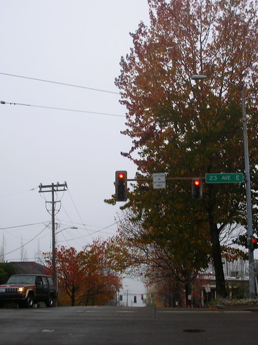
At the start of the ride, heading east on John St, crossing 23rd ave. (Came back up this way as well which was really slippery! I had to sit to keep my rear wheel from spinning)

After a screaming descent down Madison (which is almost always slowed by autos), and a quick right on Lake Wa Blvd takes you to one of the best roads in Seattle:

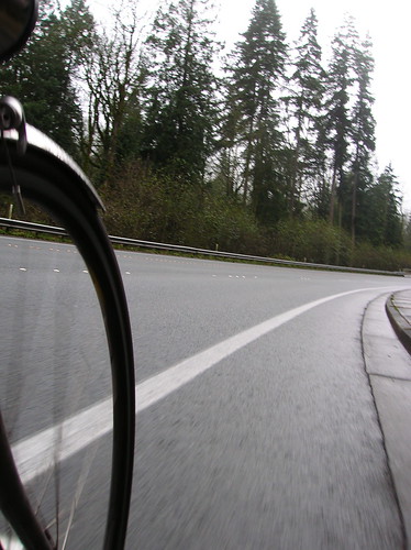
Now heading up to the I-90 trail:

I love this little downhill on Mercer Island:

Now crossing into Bellevue:

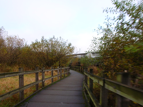
Riding through the Mercer Slough area - always a bumpy ride. I kind of hate this section.

Time to climb... but after having always done Cougar Mtn in a clockwise direction, I wanted to try something new. Plus riding up the 54th St side is really slippery on a wet day, like this one. So I took a right up Lakemont Blvd, off of Newport Way: (goes up for a mile or two, with some 10%+ sections)

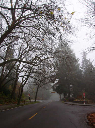
One of the downsides to going this direction is that it's less scenic than the other way - after 10 minutes of climbing it still looks like:

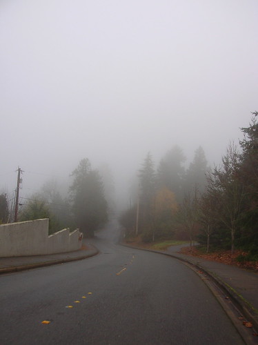
After going up Cougar Mountain Drive(?), through the fancy housing area, past the school at the false-peak, and the bonus climb (another 15-20 minutes of climbing, and a little descending), I came to this beautiful, but scary hairpin on Cougar Mtn:
(I went around that turn suuuuper carefully!)

After passing through Issaquah, and doing the Tiger Mtn loop, I turned back towards Seattle, via May Valley Road - another nice one:

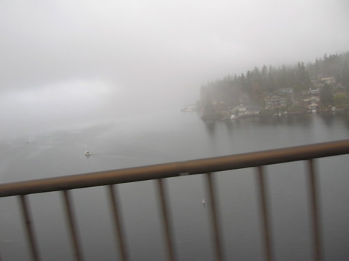
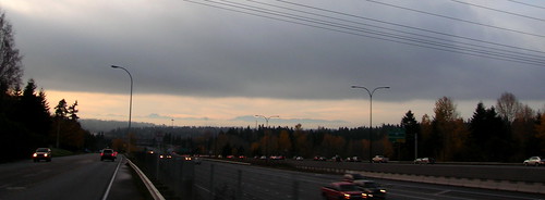
Now heading west back to Seattle near Factoria, with the Olympic Mountains in the background.

It was a great ride. I think I was the only person out in short sleeves & knickers that day, but my wool baselayer + wool SIR jersey were plenty to keep me warm! (And the Sealskinz gloves were great too). 

OK, so I might have been pushing it a bit with no sleeves - anyone else in denial that Winter is definitely here?


Tuesday, September 2, 2008

Little Spin Out to Cougar Mountain

You know me, I like to climb. I don't really like to suffer, per se, I just enjoy the views you earn by ascending, and the screaming descents as well.

On Sunday I went out for a spin, with the target of Cougar Mountain set. Rolling out at 11:30 AM or so, there was a light sprinkle in the air. Wool socks did me well, as did my wool arm warmers. The weather reminded me of last fall! I actually kind of like riding when it's a little cooler out, and maybe a little damp; like the saying goes, "there is no such thing as bad weather, just bad gear."

I headed off south on Lake Wa Blvd, and once in Renton I took Highway 900 out to Issaquah. Still more light rain, but it was the kind that you see more than feel.

At Cougar, I was 50km or so into the ride. Light rain was still falling here and there, although it had mostly stopped by now. But the roads were still wet. I remembered the first time I did Cougar, when the roads were also a little damp.

Some parts of it are covered either with slippery road, or sometimes mold growing between the cracks, offering some great spots to really have an epic 8 km/h crash!

But in the end I prevailed, and came out on top of Cougar, after 15-20 minutes of huffing and puffing. It was a little chilly up there, but a good warm-up for the upcoming "100k Mountain Populaire" coming up next weekend.

The original plan was to go all the way around both lakes, Washington and Sammamish. But after Cougar, I cut the ride short a bit and headed back to Seattle over I-90. Not too short, however, as I did some bonus kms on the Mercer Island Loop, a route that will never get boring.

The way back up to Capitol Hill was a slow one, with Madison St offering a really steep slope in some parts!

Stats:
Total Distance: 91 km
Total Ride Time: 3:47
Avg Speed: 23.9 km/h

Saturday, July 5, 2008

July 4th Spin To Snoqualmie Falls, Cougar Mountain

Yesterday I set off with a loose route in mind: Renton, Issaquah, Cougar Mountain, maybe Snoqualmie Falls. I figured it would be about 70 or 80 miles, and if it turned out to be 100, well that would've been OK too!


With the STP next weekend, and the RAMROD a few weeks after that, I wanted to combine distance with climbing - then again, it's hard not to do that around here.

Check out the elevation graph for this route - sort of like a roller coaster: (max elevation is 1,000 ft or ~330 m)
Starting out, I did the familiar Lake Wa Blvd heading south at 1:30 P.M. to the tune of a light headwind. But a headwind I could hold 32 km/h into it. By the time I hit Renton, I was
 averaging 29 km/h - a good start, but I knew the speed wouldn't last.

In Renton I believe 99% of cyclists take one look at the four-lane Highway 900 that heads uphill and think, "I'd never go up there." They're doing the Lake Wa Loop - a great route - but I never, ever, ever see anyone else riding up this hill! Come on folks, it ain't so bad.. (although the shoulder is kind of dirty, covered with rocks & debris)

Highway 900's hill is only 100 meters high, nothing special. But the descent through the thick country woods is well worth the slog through strip-mall-hell! Soon enough you're in the country, enjoying clean-ish air and stunning views.

After getting up and over the Plateau, I took Issaquah-Fall City road east, towards Fall City. After a fast downhill (didn't even touch the brakes!), I took a right and followed Issquah-Fall City Rd for a few more kilos until I hit Fall City. Here's what the stretch before Fall City looks like, awesome:

After spending a little time on Highway 202, I was at Snoqualmie Falls at about 4:39 PM. It was crowded, but there was enough space for me to squeeze in and see the Falls - wow.

I was somewhat dreading the way back, with a little climb up Iss-Fall City Road that was undulating but lasts 5 or 6 km (I think). It wasn't as bad as I thought, although doing Cougar Mountain after about 65 miles was taxing! But I knocked it out in about 25 minutes of ascension.

I tried a new descent coming down it, this time just going straight at the top and following the road all the way down to the stop sign, where I took a right. You go uphill for a few hundred meters, but then it was a BIG downhill - with a signed that warned of a 10% grade up ahead. (Lakemont Blvd?)

I hit 78 km/h (~49 mph) going down that stretch, and was pedaling so fast that my 53x11 wasn't big enough (or rather my RPMs weren't high enough). Damn I love going fast! It's a nice gradual turn at the end, compared to the tight turns going down 54th St/The Zoo climb.

Then it was a slog back up Newport Way all the way from Eastgate, and then the I-90 bike trail, across Mercer Island, and back home via 12th Ave.

Felt strong coming back up Capitol Hill - I definitely feel confident about the upcoming STP! I should be able to do it in less than the 14.5 hours it took last year.

Stats:
Total Distance: 130 km (~80 mi)
Total Time: 1:30 PM to 7:30 PM (6 hours)
Snakes Seen: 1
Flats: 0
Rain drops: 0
Food: 1 Bag of Jerky, two water bottles (ice-cream sandwich & cola at the Falls) 

Wednesday, March 5, 2008

Swallowing Cougar Mountain For Lunch

Today I made it out to the Wednesday lunchtime ride at work in Redmond, and it was a perfect day for it too - Sunny and 50F. Yesterday on the bike alias at work I suggested Cougar Mountain for today's ride, and they said yes! Sweet.

(These lunchtime rides aren't Microsoft-only, they are put on by the Cascade.org & Albert Meerscheidt, also a local PBP ancien and SiR rider.)

These Wednesday rides are "High Performance Cycling" (HPC) rides, meaning a faster pace. I've always wondered how fast the HPC rides actually are, since they say the pace is "strenuous" (18-21 mph as defined by Cascade). Could I hang? Well there's only one way to find out.

So I let my team know I'd be gone for a bit, and met up with about 10 other riders at the Overlake Transit Center in Redmond, about 1/2 mile from my building. After a few introductions, an explanation that Albert (our ride leader) had unfortunately dropped a drill on his foot and couldn't make it, we were off.

To get down to Cougar we took NE 40th St down the hill to W. Lake Sammmish, and headed south. The pace was pretty snappy indeed, and we were in the 22-25 mph range on the flats, with a good paceline going. I like pacelines, although it can be a little nerve-racking when it's a semi-serious one, and you've got to worry about touching a wheel, getting a flat, or something else that can ruin the delicate balance that is a paceline.

When we finally got to Cougar, our group of 10 had been whittled down to four of us. Oops, I guess we sped away from the other six, sorry 'bout that! We started the ascension, and one rider, Patrick, immediately spun away from us, but not in a "I'm racing you" kind of way, more in a "this is easy for me" way. The funny thing was that he'd said it was his first time doing it!

I ended up moving away from the other two riders, although I never caught up to Patrick until I found him waiting at the top - well rested and probably bored after waiting a few minutes! We waited around for another 15 minutes or so for the rest of the group (including the dropped six) to trickle up to the top.

On the way back we used a bike trail I hadn't seen yet, the I-90 trail through Eastgate (just off of Newport Way). That spit us out on about 164th St. and we followed that north back to the Microsoft "campus." On the way back the rolling hills split up the pack again, and Patrick & I ended up alone at the front, both hammering away. Not racing, just going fast. It was fun for sure, although I could've used some more calories towards the end.

Elevation profile for the ride:

(The way back from Cougar wasn't that much longer, I think I zoomed in closer when clicking the route on the way back)

Ride Stats:
Total Distance: 41.1 km (~25 miles)
Rolling Time: 1 hour 41 minutes
Avg Speed; 24.5 km/h (15 mph)
[map link]

Sunday, October 28, 2007

Solo 120 km or The Tour of Cascade Foothills

Yesterday I went out for a little ramble that went something like this route: from Capitol Hill I went East to Lake Washington Blvd, then South on that until I hit Renton. From there the plan was to head East via Highway 900 out to Issaquah and to hit up Cougar & Tiger Mountains, but as soon as I saw a group of three riders that were cruising at about the same pace I was, 34-36 km/h (21-23 mph), I just had to chase them down!

Or at least try to - even though they were heading North via Lake Wa Blvd towards Bellevue, and that wasn't the planned route. No problem, I know these roads pretty well now, so a little detour is always nice. Plus, I can easily still get out to my target-climbs from Bellevue, so why not chase down some strangers that may or may not be faster than me?

Unfortunately I never caught the 'rabbits' - alas, the stop lights in Renton gave them too much of a gap and I never saw them again. The lights or my legs weren't enough, not sure which. It was still fun though, a little sprinting-for-no-reason never hurt anyone, right?

When I made it to I-90 I hopped on the trail and headed East to Issaquah, where I hit up Cougar Mountain, the 3-mile, 1,400 foot climb that makes or breaks a cyclist in these parts. This was my first go at that climb on the new Ciocc, which has a low-gear of 39x23 (~44 gear inches), a little steeper than the Eros. I made it up, and the stiffness of the frame easily evened out the steeper gear; although I can't say it was easy. The air was definitely nippy up there, and after slipping on my arm warmers I descended down as fast as safety would allow, which wasn't very fast at all - I probably topped out at 65 km/h down Cougar.

Then it was off to Tiger Mountain, about 10 km away just South of Issaquah. At the bottom of Cougar Mtn take a right on Newport Way, follow it to Front St, then take that South to Tiger Mountain Road on the left. Tiger's not a monster-climb, but at about 800 ft it's not small either. Luckily the roads were dry enough that I could blast down the 'mountain' - although I never could get much over 72 km/h (~46 mph). Guess I'll have to go over to Tolt Hill Road to really get the speedy descent I'm looking for.

Here's a profile of my 'Tour of Cascade Foothills' route (out to and including Tiger Mtn, but excluding the trip back):


I love how Cougar/Tiger Mountains put Capitol 'Hill' to shame!

Here are the ride totals:

Distance: 120 km (~75 mi)
Total Time: 5 hrs 30 minutes (my cyclo-computer reset, not sure of rolling time, it was probably something like 5 hrs)
Elevation Gain: ~4,000 ft
Road Kill Seen: three, all on May Valley Road - they must not clean it much.
Best Scenery: Mt. Baker & Lake Sammamish as viewed from the top of Cougar Mountain - that makes the pain worth it!

Sunday, September 9, 2007

Cougar Mountain Climb, with Photos

The Cougar Mountain/Zoo climb is one of the Seattle-area's premier climbs. Sure, it feels great to crest Queen Anne, but how about three of those in a row? Now that's a climb! At about 1300 ft at the top, the view is pretty sweet.

And if you go, don't think that the painted finish-line at the top means the climb is over; take a left on Cougar Mountain Way for another 300 feet or so of steep climbing!

The view looking East towards the Cascades and Cougar Mountain (which is probably one of the peaks in the skyline, not sure which one)


About 15 km later in Eastgate on Newport Way, heading towards our destination:


A view of our speed (in kilometers/hour) going down Newport Way (only about 30 mph).


Here's the beginning of the three mile Zoo climb, on 54th St just off of Newport Way:


Maybe a half-mile into it, getting into a great part of the climb - on a wet day, the shoulder is slick here, so be careful:


Here I am struggling around the crazy hairpin turn (that I almost crashed on once going down). Thanks to Dennis for the great shot!


A short video of part of the climb:


Heading up towards the top of the climb on 60th St., here's where the rollers start:


Dennis cresting the almost-top - note the cliff behind him, that's what we just climbed! It's gotta be a good 20% in that last little section..


You might think you've reached the top when you see this, but you haven't; take a left on Cougar Mtn Way for more pain. With no undulations, you'll miss the 'rolling hills' you just came up to get to this point, but keep going, you're almost at the top.


The view is so much better after you get a bit higher; here you can see Lake Sammamish, Issaquah, Redmond, and snow-capped Mt. Baker in the distance:


My machine, complete with bell, soon to be replaced by a Ciocc:


Climbing up Madison St back in Seattle. Note the slow, slow speed of 6 friggin km/h!! Yeah, that's like 3.4 mph if you're keeping track. But hey, it's steep on that part of Madison!


It's always a tiring ride when I do Cougar Mountain, but not as much as doing the two-lakes loop & Cougar Mtn, that's a real killer. Good training for the HPC!

Monday, July 30, 2007

Cougar Mountain aka The Zoo Climb

I'd heard about 'the zoo' climb before, but had no idea where it was - but lo and behold, somebody saved the route on my site, veloroutes.org! (as a side-note this is how I know the site is working - not just saving my own routes but discovering new ones!)

The climb is 2.5 miles long, and gives you over 1K feet of elevation gain! This is about twice as big as Tolt Hill Road, which used to be the best (or worst, depending on how you feel about climbing) local climb I knew about. Probably the hardest local climb excluding the mountain passes like Snoqualmie and Stevens.

The Ascent:

The first section of this climb is probably a good 10% grade, and it seems to fluctuate between 7 and 10%, but I'm estimating, so I can't be sure. My rear tire was skidding a bit going up, due to the dampness that was still on the ground and the steepness of the road! About half-way there's a small plateau of sorts to give your legs a rest, but once you turn onto 60th St the rollers start, and they seem to get steeper and steeper! Some of them towards the end must've been over 10%, at least it felt that way. Once at the top you can take a hard left and continue up the mountain for a quarter-mile or so, which I now call it the "bonus climb."

The Descent:

You might think that since this is such a big climb that the descent would be a screamingly-fast one, but it's not! The hair-pin turns force you to keep your speed way down, and I almost learned this the hard way: I was coming down the first hairpin, my bike started to drift more and more towards the guard-rail on the right side of the road, and the wet mold next to it! It's a scary feeling when you know you can't slam on the brakes due to the damp ground, and you can't do a hard turn 'cause you'll slip, so I just had to ride it through while tapping the brakes! I came within maybe less than a foot of the edge, and got to peer down the steep slope that probably drops a good 40 or 50 feet! Scary sight indeed. Next time I'm gonna go as slow as a snail around those turns!

The Views:

You might also think that being 1,100 feet above sea-level you'd be able to see the city and lots of cool sights, but you can't; there are lots of tall trees blocking most of the views! You can see Lake Sammammish pretty well, and the Eastside as well. Definitely puts 'hills' like those around Bellevue into perspective, that's for sure! The 'bonus climb' had a little clearing that gave a pretty good view of the Cascades, but that was about as good as it got.

To sum it up, this is a great climb, but don't get your hopes up about a fast descent - Tolt is better for that.