Monday, September 22, 2008

Oregon Rando's Desert River 600k - Finished With Three Minutes To Spare!


After DNFing two previous 600k's this summer (1, 2) I was eager to give it another shot. Yes the last attempt was only a week ago, but this was my last chance to do a successful 600k brevet and earn the "Super Randonneur" title for 2008.

It was one hell of an experience. At some points I was speechless in awe of the beauty of the route; at other points I was cursing south-eastern Washington, wondering why anyone thought it was a good idea to ride in this area. But the "randonesia" is now setting in, and good memories are starting to stand out.

Full photo set can be viewed here. Map here.

Highlights (out of order)

Reith Road - one of the highlights of the whole ride:


Funny Sign in Umatilla, OR. Most riders probably didn't see this, as it wasn't on the route! But after 100 miles I'd decided the route wasn't long enough for me, and that I needed a 5-mile detour! (Actually, I read the cue wrong and got lost..)

Along Highway 14 heading east:

Riders on Highway 14:

The Pacer had a great ride too:


Control in Prosser (I think), the morning of day 2


Awesome canyon road (near Goldenwater, WA I think):


Bickleton, WA - the only services in a 60 mile stretch:

Wind power - you know strong winds are in store when you see turbines in the distance:

A few notes about the ride:

* ~22 starters, ~5 DNFs (I think)

* Schedule:
day 1: 6 AM start, ~1 AM finish (220-mile mark, two hours of sleep at the motel)
day 2: 5:30 AM start, 9:57 PM finish.

* This was one of my first rides without using a cyclocomputer. On super-long rides like this it's nice to actually not know exactly how far you've gone or have to go. For reading the cuesheet, I used this formula: .1 miles means I should be able to see the turn already. 1 miles means wait a few minutes, then look for it. etc. So far the method works pretty well!

* The cue sheet had about four errors on it. Got lost a few times. Also got 5 flats! (And actually used my spare tire, which then got its own piece of metal lodged in it)

One such error was in Sunnyside; the cue said left on S 16th St, but we only say N 16th street. So we continued for a mile out, then turned around wasting valuable time (see below)

* A few other riders and I missed the cut-off time for the Goldenwater control (2nd to last). On the way there from Mabton, Jim & I knew we needed to keep roughly a 12 mph average over the next 60 miles. 

But with the hills and winds, we also knew it was going to be a challenge. I worked the hardest I probably every have on a bike the last four or so mles to the control, basically devastated when I could see the control yet it was already 6:20 PM (the cut-off time). 

I'm hoping that since the cue sent us on a few detours that this can be overlooked by the rando-gods; we shall see. Either way, I'm happy to have completed such a ride!

* My nutrition for the ride consisted of bananas, cheese, chips, v8 fruit juice, ensure, jerky, donuts, dinner at subway, breakfast at mcdonald's, and plain water (e.g. human food. or close enough to it).

* A few assumptions that I learned were wrong: 

1) This brevet would be easier than a SIR 600
2) The wind dies down at night
3) It's all downhill from Goldendale to The Dalles (I wanted to slap whoever said that!)

Thanks a million to Paul Whitney and the Oregon Randonneurs for putting on such a great ride!! Also huge thanks to: Jim for riding with me for a while and letting draft you forever; Narayan & everyone for talking me out of quitting at the 2nd-to-last control; Mike for giving me an Ensure, and staying with me while I fixed one of my many flats on the first night; Bill for the complements on the Pacer; R.B. for letting me take a shower in his room at the end; And a huge thanks to Gary for giving me a ride down there, making this whole trip possible!

Now having completed two 200k's, two 300k's, two 400k's, this 600k rounds out my first rando season nicely. Can't wait for next year! Until then, there's a big list of rides I'd like to do.

Friday, September 19, 2008

Seattle To Preston, By Mistake

I meant to take the Pacer (complete with newly installed Honjo fenders) out for a photo-heavy spin to Snoqualmie Falls today.. but instead ended up in Preston (a little west of the Falls)! It was a little anti-climatic compared to my original destination, but still a good ride.

The new fenders felt solid, though they did hum & rattle a tiny bit. And I had to switch back to the Gatorskin 25c's, since the wonderful Grand Bois 28's run on the fender.. I might get some GB 26's, and possibly try out some 28's from other makers, as the GB's are known to run a bit wide.

Rolling with the new Honjos:

Bog on Issaquah-Fall City Road


Finished, time for a burger & fries (Dick's on Broadway)

Total Distance: ~102 km
Total Time: 5 hours 20 minutes
Map:


View Larger Map


A few more photos can be found here.

In other news, I'll be at the OR 600k this weekend, down in The Dalles!! Another chance to claim the "Super Randonneur" title, stay tuned!

Tuesday, September 16, 2008

City Hills: Madrona, Queen Anne, Capitol Hill

The Pacer is in the shop, getting the new Honjos put on - can't wait to see it in person! Although apparently the Grand Bois 28c won't fit with the fender in the rear.. damn. I can probably at least run 26's on it.

So tonight I took the Ciocc out for a spirited ride, initially to do the Mercer Island Loop. But a few kilometers away from the apt, I realized I'd forgotten a pump! So instead of doing Mercer, I just kept it in the city. Closer to the population of other cyclists, with pumps hopefully!

Ride Description

First, the elevation graph of the route I ended up doing: (max height 439 feet)
From Capitol Hill down to Lake Wa Blvd, right on Madrona Dr (big 1 km+ uphill), follow Union st all the way to Broadway (hilly). I held 16 km/h (10 mph) for the first few minutes going up, but eventually dropped down to 10 km/h (6 mph). The Ciocc climbs well, especially when unloaded & the dynohub taken off!

From there I came back west to Broadway, and bombed down Denny Street over I-5. Probably hit my top speed in the route, 67 km/h there! At that kind of speed in the city, cars start to hold you back. I'd love to do a road race in the city some time, and have that be part of the course!


Then there's Queen Anne, easily the steepest part of the route, heading up to the views of downtown at Kerry Park. Had to take a little diversionary right on a less-steep road on the way up, on which I rode half way up, turned around, and then re-attacked Queen Anne Ave. It's so damn steep!

Then I came down the other side of Queen Anne, and on the way back I held a good 25 km/h heading up the little Dexter hill. Took a left on Denny (crazy traffic) and followed it all the way back to the Hill. Even kept in the 53-tooth ring coming up the steep section next to Whole Foods! Granted, I was grinding at probably 30 RPM, but it was actually a good feeling. I felt like the chain was going to snap before I would.


If the Oregon 600k pans out this weekend, I think I'll be well-prepared! And I felt surprisingly well, given all the climbing on Saturday.


Route Distance: 21.5 km
Rolling Time: 1 hr 2 minutes
Overall Time: +5-10 minutes?
Average Speed: 20.4 km/h (12.6 mph)
Map Link: here

Sunday, September 14, 2008

SIR's September 600k: Another Epic DNF

Prologue

If you look at the timestamp on this post, you will either surmise that I was really fast in finishing the 600k, or instead that I didn't finish it.. well unfortunately it's the latter case.

But it wasn't a total loss, and I'd even say it was a great ride. (Although finishing it some day would be fun too - anyone want to make a Permanent out of this route? I'm already itching to give it another shot.)


Anyway here's my story of attempting yet another 600k.

Challenges Before The Ride

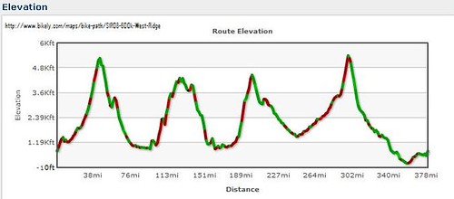
From the outset I knew it was going to be a long day. (And by "day" I mean the 22-28 hours of bike riding I expected it to take to get to Naches, about 400k into the ride.)

Just as I'm about to launch for the ~7 mile ride to Robert's house, I realize my cycling shoes are at work! And work is in Redmond.. argh! I tried on some old Speedplay-equipped shoes but they were really uncomfortable and tight-feeling. Could I stand that for 30+ hours? Hell no. I needed my other shoes.

With all the packing I'd done getting ready for the ride, you'd think I would have looked for my shoes too. Should've done a pre-ride "shakedown," but these things happen. Lucky for me Kira was sweet enough to drive me out to Redmond, and then all the way down to Eatonville as well! Thanks, baby!! The ride wouldn't have been possible without you.

Even on the way down to Eatonville we thought we were lost; Our Mapquest directions were basically wrong in the Puyallup area, but a general sense of direction, and optimism that we were on the correct highway, kept us going in the right direction. Eventually we made it at 3:30 or so, with time to prepare.

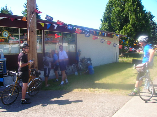
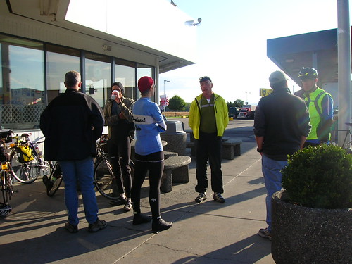
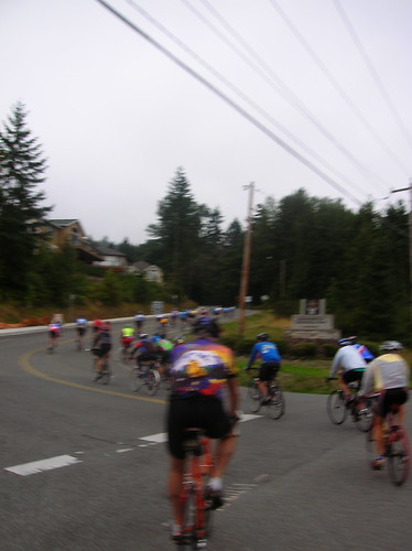
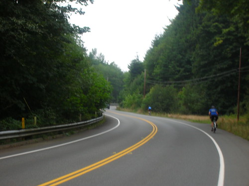
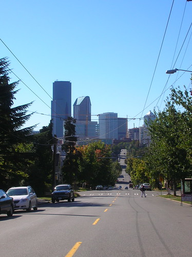
The brevet start in Eatonville, WA at 4 AM

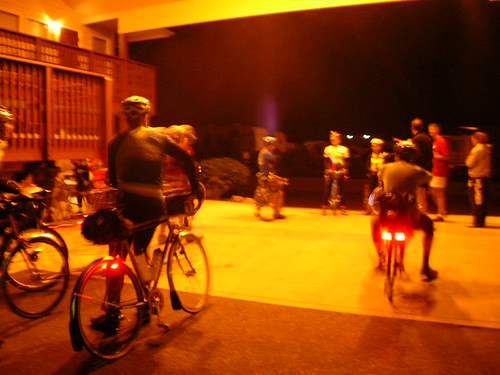
We started in the dark of course, with all of our lights looking like travelling Christmas trees. I was in the front of the pack at first, until two riders (Bob B & Robin P I think) sprinted past us like a breakaway by one of the French teams at the start of a TdF stage.

It was chilly but not too bad; my arm warmers & wool jersey, and shorts were plenty to shield me. I rode with Jacques from Alaska for the first hour or so, chatting about the crazy races he's done (like long-distance paddling races, snow-biking), and the brevets he's done around the country.

Bob & Robin were still ahead of us, but we kept their tail lights in sight for quite a while, surpsingly. For some reason I decided to ride sans cyclocomputer for this event, so I have no idea what our pace was exactly. But we must have been going at a decent speed, since looking back on some stretches I couldn't see anything, not even the flash of a rando's headlamp.

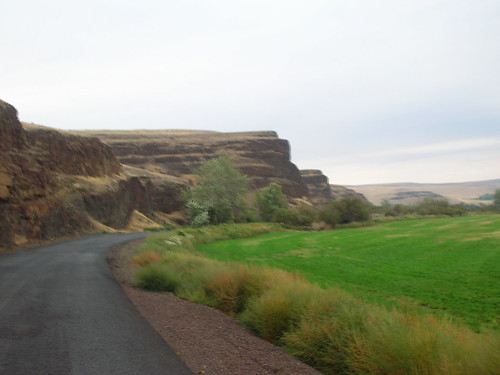
Upon entering the Rainier National Forest (I think we were supposed to pay at the ATM thingy, but riding through there was no attendant so we just kept riding.. I didn't have change anyway), it was time to ascend to Paradise.

Climb to Paradise

While at this point I was well ahead of most of the pack, I knew I'd be seeing most, if not all, of them at some point further down the road. I took a "arret naturale" and waited for Robert, Jack, and Dan (or some combination of them) to show up. The sun was rising now, and the darkness was being painted with lush green forest.

After only a few minutes Jack & Dan rode by, so I caught up with them. We rode together for quite a while, chatting and generally just enoying the beautiful scenery. Dan climbed quite fast, but was nice enough to wait for Jack & I a few times.

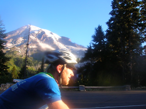
Eventually Andy caught up with us, and the four of us kept chugging our way up the mountain. The view of Rainier was clear, not a cloud in the sky! It was truly going to be a perfect day, at least weather-wise.

Jack looking strong climbing up to Paradise.

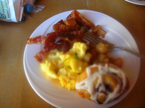
Breakfast At Paradise - 69 km, 7:53 AM

On the last three-mile stretch up to the lodge, I was dropped by the pack of three I'd been riding with. My heart rate felt a bit fast all day, and already I felt like I was pushing it too much. When you've still got at least 30 or more hours left in the ride, the last thing you want to do is redline!

I let them go, and just soft-pedaled up to the Paradise Lodge. Mt. Rainier looked extrememly cool, and once in the lodge I spotted a breakfast buffet. Having only had two croissants and a banana before the start of the ride, I was wanting something solid.

Each silver container contained hidden goodies, as if I were opening a treasure chest. Bacon?! Sounds good. Eggs? You bet. Oatmeal? Sure. Hash browns? Oh yeah. Even grabbed a pastry too. Paradise indeed! My eyes were bigger than my stomach, and I regretfully had to leave some scraps behind. I left a $20 bill on the table for my $12.95 breakfast; partially out of sympathy as a former food-worker myself, but mostly because it was time to hurry, no time for change.


The downside to this 15-minute break was that I lost contact with Jack/Dan/Andy/Robert in the process. Time to play catch up. With a full belly, and a renewed sense of strength, I set off to enjoy a blazing descent! I think descending mountains (on a clear day) could never get old.

I rode alone for a good two hours on the way to Packwood, being passed by litterally about three cars the whole time! After the ~5-mile climb up Backbone Ridge, I was greeted by smiling faces providing a refill of water, which was much appreciated. They said it would be a nice pedal down to Packwood from here, but I had no idea how nice! It was pretty much all downhill from there to Packwood, about 20 miles away.

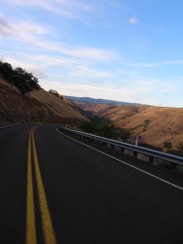
After turning right on Highway 123/12, I realized I was descending the last part of Cayuse. At the intersection of 12, taking a right, I then thought about how we'd be coming back up this way later on, as this was the bottom of White Pass. The next 8 miles were an easy downhill to Packwood. (Which of course translates into an eight mile climb later on to get back there)

Packwood, The First Time (124 km, 10:25 AM)

Much to my surprise, I found my group of four at the gas station in Packwood, getting ready to head out. I made record-time in getting in and out, probably five minutes max. After a short sprint I caught up with this group of four strong riders, and I was glad to be in the company of humans again.

This gas station was right next to where the High Pass Challenge starts. Interestingly, we were about to ride the equivalent of the HPC!

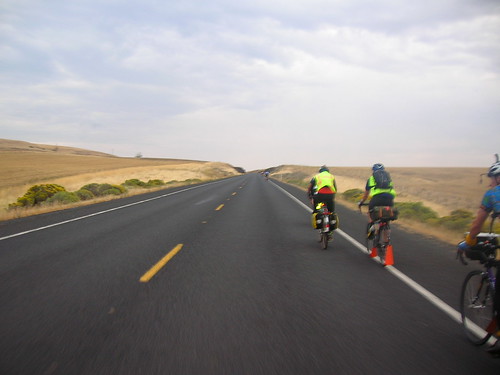
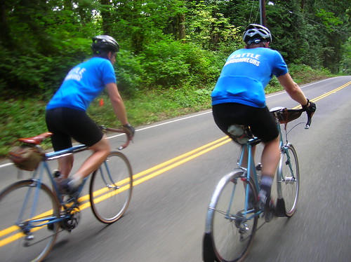
Riding with Andy, Dan, Jack, and Robert on a back road west of Packwood:
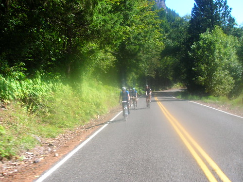
Resting in Randle, WA - I had no idea how hard things were about to get!

Windy Ridge

One of many washouts we encountered on FS26, heading up to Windy Ridge. Just before this we encountered a SIR sign with an note that we could choose either FS25 or FS26, and that 26 was filled with "adventure" and washouts.

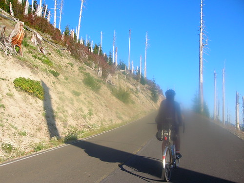
And indeed, it was one of the most challenging roads I've ever done! But also one of the most scenic. Well worth the effort. Jan & Ryan did an excellent job laying out the course, and I hope to see the rest of it some day..
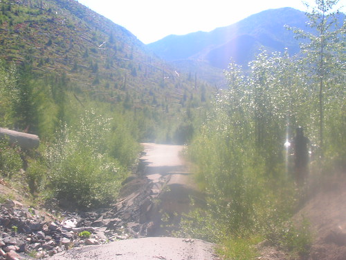
Robert climbing in the Mt. St. Helens Blast Zone.

Robert enjoying the ascent to Windy Ridge.

One of many cracks in the road on the way down from Windy Ridge. The advantage to these broken roads was that cars weren't allowed in this section! It made for some very peaceful riding.
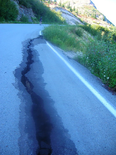
 Blast Zone.
After getting a PB&J sandwich from Jan, we set off to make our way back to Packwood. Jan had graciously lugged a whole trailer of food & water just for us! It definitely helped, thanks, Jan!

Packwood, The Second Time (288 km, 8:46 PM)

I arrived in Packwood at about 8:45 PM, surprised again to spot the trio of Jack/Andy/Dan there. They were about to leave, but it at least gave me a renewed confidence that if we weren't going to make it to the next controle in time, we weren't the only ones. Or that if we were this close to the rest of the ride(rs), we really weren't as far "behind" as it seemed.

Robert & Mark showed up shortly after I did, things were coming together. We'd figured it was going to take about four hours to conquer White Pass (20 miles of up I think), which would put us up there at roughly 1 AM, with 45 miles to go. And the 400k-mark cutoff time was at about 6 AM, so it was doable but the main question was would we get to sleep?

I got my card signed, filled up on water (with an extra bottle jammed in my rear pocket since the next 100k were sans any services!), and downed some food. White Pass loomed in the distance, daunting in the dark.

The End

But as Mark pulled out it sounded like Robert was hurting. Achilles tendon I think he said was acting up, and that he wanted to call it a day. And knowing that Robert has already done a succesful 600k and is a strong rider, I knew he was in serious pain.

And this was enough to give me a way out of something that was actually pretty scary to me: going up White Pass in the dark. I guess we knew all day that this was going to be the case, but now that reality had set in, I took the easy way out.

On brevets I think the unsupported part is what gets me through the ride. If it's 3 AM, you're hundreds of miles away from home, out of cell coverage, quitting might not be a real option. That really helps will power, because at that point it's either sit still or stay on the move, towards the finish and a chance to rest.

But with an actual option of being able to bail, the choice was too much to resist. My lack of motivation got the best of me. Part of me also didn't want to leave a friend alone; while I knew he'd be fine, with Jane & their friend just starting a drive down from Seattle, it was going to be a while before they got there. Would I want to sit alone there for hours? Nobody would.

We sat around and ate a few servings of "cheese" nachos, a few sodas, and lots of phone calls. We estimated maybe $5 worth of quarters in those things..

The locals kept us pretty entertained, and one even gave us this chilling tip: "Don't go to the bar," he said to us after giving us a good look up n' down. He also mumbled something about dog shit after that, and then went inside. I guess he's in the anti-lycra camp?? That is until Sunday football comes on..

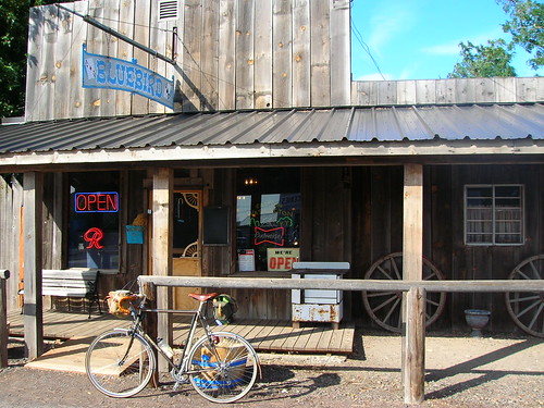
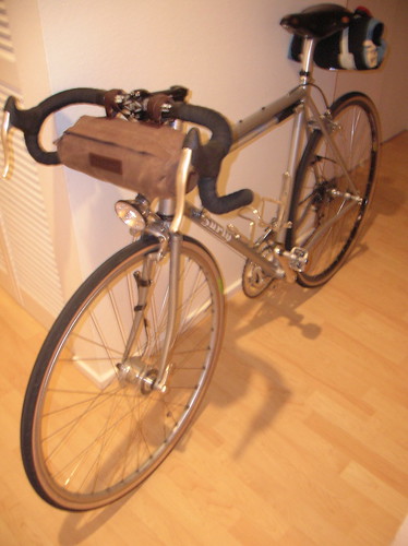
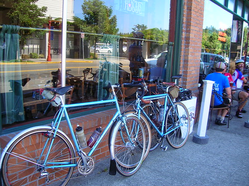
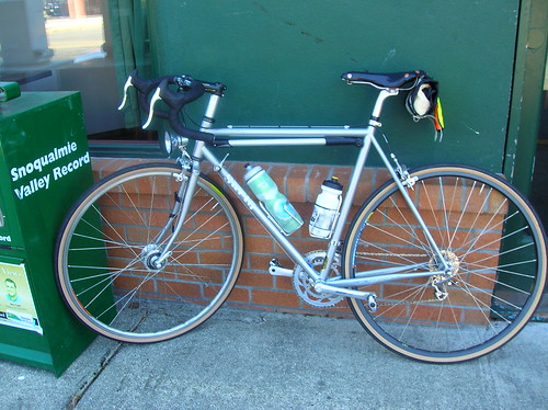
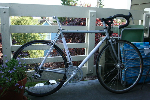
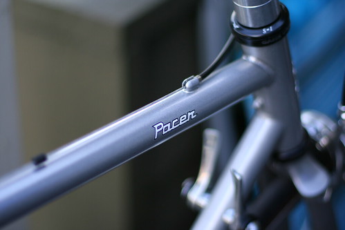
Our bikes in Packwood (that's my new Pacer on the left):
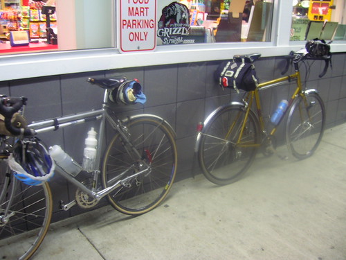
Robert's wife Jane and their friend graciously drove down from Seattle to scoop us up (thanks a mil!!). We ended up waiting until about 12:30 AM, and I could only think about the riders that were probably still ascending White Pass.

I got home at roughly 3:30 AM, and I was dead tired. Most of the riders were probably still going at this point, I kept thinking. But I was glad to be home. Congrats to all the riders that finished or attempted this great ride!

I might do the OR 600 starting in The Dalles next week, which would allow me to at least get a Super Randonneur medal for the year. I'll keep you posted!

Ride results are here: link

The photoset on on flickr.

Friday, September 12, 2008

Prepping for THE 600k

On Saturday at 4 AM, me and at least 20 other randos will be rolling out from Eatonville, WA, on a 600 kilometer (372 mile) brevet.

I've been a bit nervous about the ride all week. Actually, not nervous about the ride itself, but being scared of something getting in the way of even doing the ride. What if I fell down stairs, and broke an arm? What if I got sick and couldn't make it? That just wouldn't be acceptable!

But it's the day before the ride, and I'm feeling good. "All systems pro" as Dennis says.

Upon checking the ride page for Jan & Ryan's upcoming 600k, I noticed this ominous note:

A mini-survival blanket is required - available at mountaineering stores. A breakdown at night on a mountain pass could result in hypothermia.
OK, so that's just a tad daunting, wouldn't you say? While Seattle is gearing up for a hot weekend, 4,000-5,000 feet above sea level can be quite chilly! And since no on-course support is allowed on these rides we would indeed have to fend for ourselves in the case of an emergency. Not to mention that we'll most likely be doing at least White Pass in the dark.

During last year's High Pass Challenge, I remember freezing my ass off up at Windy Ridge (which we'll be visiting again during this ride), and that was during the day! But on a positive note, a rider from this year's HPC said that it was about 75F up at Windy Ridge, so maybe we'll get that good weather as well (and maybe I'll actually be able to see the St. Helens this time too)

Packing List
  • jacket
  • leg warmers, arm warmers, rain pants
  • heavy wool socks
  • reflective stuff (sash, ankle bands)
  • tools, patch kit, etc (the usual things, and even a denim strip for a just-in-case tire boot)
  • emergency bivvy
  • two plastic QFC bags (for under my booties in case we get heavy rain somehow)
  • long-sleeve wool jersey
  • winter hat
  • shoe covers
  • long-fingered gloves (SealSkinz), short-fingered gloves
  • two full-size water bottles
  • to wear/carry: SiR short-sleeve wool jersey, bike shorts, light socks, tube, glasses, money, etc

So how will I be carrying all this stuff? In the smallest way possible. I just hope the seams don't bust on the Cape Roll!

Here is my Rapha jacket, tools, and the emergency bivvy, all to be stuffed into my Carradice Cape Roll:


This week I got a new Velo Orange bag in the mail, ready to be stuffed with way more crap than you'd think could fit in it. About to put in a long-sleeve wool jersey, a winter hat, light booties on top of the rain pants I already have in there:

Oh but there's more! Much to my amazement, I was also able to squeeze full leg-warmers in there as well:

The full-loaded bike can be seen below. Maybe a bit minimalist for a 600k setup, but I think I learned the lesson of "Don't carry too much crap" on the last 600k I attempted. After all, we'll be ascending four full-fledged mountain passes on this ride!! Gotta keep that weight down, but at the same time be self-sufficient:

I thought about using an Ortleib handlebar bag at first, but didn't like how high it ended up (needed extra clearance for my E6 lamp). With the bag loaded (mind you only with clothes and the bivvy), it felt strange with all the weight up so high. Eventually I'd like to have a nice handlebar bag on the Pacer, but I'll need to re-position the E6 lamp first.

So you might be thinking, "That's great. But what about food and other goodies?" Well my friend, that's what jersey pockets are for! That and my stomach is a great place to store food. And by "food" for this ride I mean mosty peanuts, jerky, V8 "fusion" drinks, and a "mystery-meat" sandwich or two from gas stations. Oh and Tim's Cascade super-salty chips. Nothing fancy, but enough to keep going. (I've learned the hard way that sugary items, like candy bars & soda, only lead to an upset stomach)

So what's the terrain on this ride gonna be like? One only has to look at the elevation profile to gauge that:
Those big spikes are the climb up to Paradise (did that one on the RAMROD), then up to Windy Ridge, then White Pass, and finally Chinook Pass. I'm looking forward to Chinook, as it's the only one I have yet to do. I actually enjoy rides with gigantic passes in them; adds a few punctuations to the ride that let you know where you are along the route.

Here's a bikely map of the route: link.

Also a few riders have posted about their pre-rides. Both stories are great reads!

  • From Green Hornet Rando blog: link
  • From Ryan's rando blog: link

Btw, if you're reading between 4:00 AM PST 9/13 and ~4:00 PM 9/14, I'm probably still doing the ride!! Good luck to all the other riders, and thanks in advance to Jan & Ryan for organizing this whole crazy thing.

Sunday, September 7, 2008

SiR "Mountain Populaire" 100k

Today was a local event that I've heard about almost as many times as the STP. It was finally time for SiR's 100k Mountain Populaire! This is an annual event put on by SiR's very own Kent Peterson.

Initially I was signed up to ride the HPC, but given that it fell on the same day as the Populaire, I gave away my HPC ticket and set my sights on the Populaire. (Not to mention that riding the HPC would be redundant since I'll be doing that ride (Windy Ridge) as part of our upcoming 600k)

So I set out Sunday morning, eager to do a real first ride on the newly-built Pacer, with its brand new Grand Bois 28's. In summary it was a great ride! And while the Pacer is obviously heavier than the Ciocc, I don't think it held me back at all: I finished in 4:50, in the top 10 of all riders on the course. Nice to know that comfort and speed don't have to be mutually exclusive. It's really the engine that matters most I think.

Left the crib at 7:30 AM, later than I wanted since the ride started ~14 miles away in Issaquah. I had no idea what time it was (watch is broken), or how far I'd gone (haven't hooked up cyclocomp yet), so I wasn't sure if I was going to make it.

Then about .5 miles from the start, I saw the peloton going the other direction. I was late. Again. So I stopped and got some photos of course!

The whole pack. Time to catch up!! (Meaning I never went to the start, so I didn't have a control card, and hence I didn't get an official finisher's pin at the finish)

The pack attacks Cougar Mountain. Or was it the other way around?

Another Cougar action shot. On Cougar I moved from the rear of the pack to the front third. Eventually caught up with Jack B, who was holding a strong pace all day.

Now riding with Jack B, his buddy Tom, heading up Tiger Mountain. I'd never done it in this direction (CCW), but it probably a tad easier this way.
Lunch in Carnation, at Sandy's Espresso. On Tiger Mtn I dropped this very piece of jerky on the road, and Joe P commented that it looked like a piece of wood! Hey if wood had that much salt on it, I'd probably bring it along on rides too.

Riders refueling in Carnation.

Now climbing Tolt Hill Road. Ouch. Actually it's not half as bad as Cougar Mountain, but it still took a while. Tom said he did it in his big ring!! No wonder he was so far ahead of us.. Big thanks to Jack & Tom for waiting for me at the bottom.

Grand Bois tires & a Schmidt E6 headlight; essential rando elements.

Finished! Now we're at the brew pub in Issaquah. 

The Pacer, enjoying its first day on the road. And a great day it was!

Now heading back home, in the city. I love riding from the city, to the countryside, and then back.

It was a great ride, and I highly recommend it to anyone that likes to suffer (or excel, as the case may be) on hills!

Ride Stats:
Distance: 14 mi there, 70 mi ride, 14 mi back = 98 miles total
Populaire ride time: 4:50
Maphere

Friday, September 5, 2008

New Surly Pacer!!

Picked up the new velo today, and all I can say is I love this thing already. It feels maybe a tad heavier than the Ciocc, but I'll take that to get the great (tire) clearance this bike seems to have.


Fresh from the shop, without a seat, pedals, and lighting system; all essential elements of a transportation vehicle:

Components are:
* Campy Veloce Compact Cranks (50x34)
* Shimano Ultegra derailleurs
* Shimano Dura-Ace downtube shifters (only the best!)
* Shimano brake levers
* Shimano long-reach brakes (to fit nice fenders)
* Nitto seatpost
* Easton EA50 stem
* Ritchey "WCS" handlebars
* Mavic Open Pro wheels, with Dura Ace rear hub, Shimano 3N71 dynohub in front


My Brooks Swift:

Surly Pacer Meets Seattle. It spun up Yesler nicely, as well as Queen Anne Ave! (mostly thanks to the 34x27 gear)

So far I like the bike a lot, although I'll probably chop part of the steering tube off. While it feels really comfortable to have the saddle that high, it just feels weird for some reason..

Tuesday, September 2, 2008

Little Spin Out to Cougar Mountain

You know me, I like to climb. I don't really like to suffer, per se, I just enjoy the views you earn by ascending, and the screaming descents as well.

On Sunday I went out for a spin, with the target of Cougar Mountain set. Rolling out at 11:30 AM or so, there was a light sprinkle in the air. Wool socks did me well, as did my wool arm warmers. The weather reminded me of last fall! I actually kind of like riding when it's a little cooler out, and maybe a little damp; like the saying goes, "there is no such thing as bad weather, just bad gear."

I headed off south on Lake Wa Blvd, and once in Renton I took Highway 900 out to Issaquah. Still more light rain, but it was the kind that you see more than feel.

At Cougar, I was 50km or so into the ride. Light rain was still falling here and there, although it had mostly stopped by now. But the roads were still wet. I remembered the first time I did Cougar, when the roads were also a little damp.

Some parts of it are covered either with slippery road, or sometimes mold growing between the cracks, offering some great spots to really have an epic 8 km/h crash!

But in the end I prevailed, and came out on top of Cougar, after 15-20 minutes of huffing and puffing. It was a little chilly up there, but a good warm-up for the upcoming "100k Mountain Populaire" coming up next weekend.

The original plan was to go all the way around both lakes, Washington and Sammamish. But after Cougar, I cut the ride short a bit and headed back to Seattle over I-90. Not too short, however, as I did some bonus kms on the Mercer Island Loop, a route that will never get boring.

The way back up to Capitol Hill was a slow one, with Madison St offering a really steep slope in some parts!

Stats:
Total Distance: 91 km
Total Ride Time: 3:47
Avg Speed: 23.9 km/h