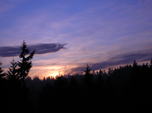
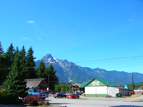
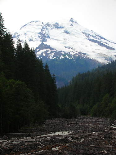
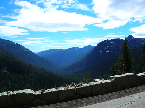
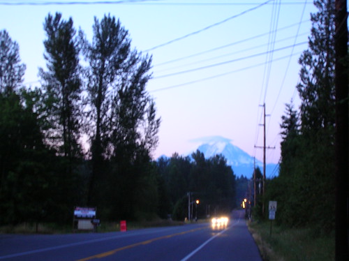
Mt. Rainier in the distance - about 20 miles away from Enumclaw, you can clearly see the mountain! It was great to be able to see the object of our obsession all through the day, I can't imagine doing this on a rainy day, when you'd get no perspective on where you are/going.
Lenticular cloud atop the mountain - I seriously shouted when I saw this, and just had to stop for a photo:
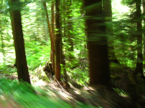
Now in Rainier Natl Park - lots of woods. But the air smelled seriously fresh. Like in those commercials for fake smells, but for real.
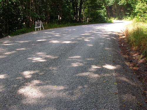
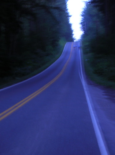
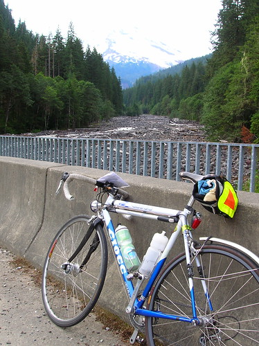
Unpaved section of Cayuse, looking down the incline - there were lots of these, but going uphill they weren't too bad, just a little bumpy.
The Ride To The Ride (Capitol Hill to Enumclaw)The plan all along was to turn down all generous offers of car pooling, and to pedal my way to Enumclaw, the start of the ride. Google maps said it was "only" about 38 miles to get there, via Renton & Highway 169.
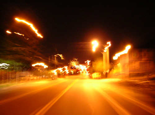
So I rolled out from the apt at 3:15 AM, giving me enough time to make it there by 5:30 or 6, probably closer to six. In pitch dark, I rolled down Rainier Ave, with little traffic, and surprisingly there were people waiting for buses - as their night was most likely ending, a new day was beginning for me.
Once in Renton I followed a few turns that brought me to Highway 169/Renton-Mapple Valley Road, not sure what to expect. I'd heard that the first section was less than enjoyable, with no shoulder, but traffic was light. At rush hour this would be kind of crazy, but doable. At this point I'll ride on pretty much any road that isn't
closed to cyclists!
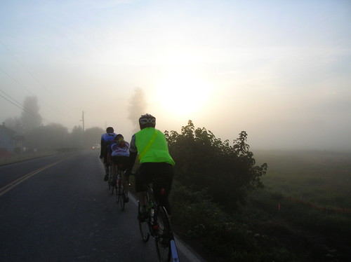
Eventually I rode into thick fog, my dynohub'd Scmidt E6 lamp doing well to keep me going forward. A blinky light would have been useless. As the elevation seemed to rise, the temperature dropped. I stopped and put on my jacket & long-fingered gloves ("seal skinz"). Those gloves are wonderful; they block wind/cold, and supposedly water too. If I've learned anything from randonneurring its to be prepared for anything, because it might be a long day. THe forecasts were for the 70's, but 3 AM in the foothills of the Cascades can be a different story.
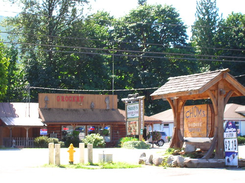
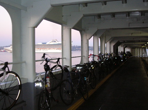
Enumclaw
At about 6 I rolled into the 'claw, glad to be there without any mechanical issues to hold me back. The starting area, Enumclaw High, was empty except for a few other late starters. I found the free breakfast of waffles, and though they were out of utensils I made a waffle/butter/syrup sandwich that really hit the spot.
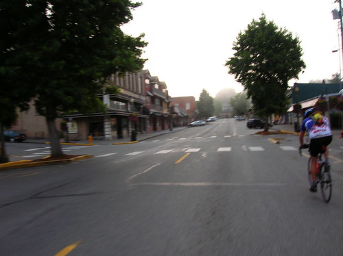
I took a wrong turn in the first mile of the course, trying to follow the cue sheet in my hand. I followed a roadie on a left that just didn't seem right, and sure enough as I turned the next corner he was heading the other way. He didn't seem to have a cue, but I looked at mine and notice we'd only gone .4 miles instead of the 1.4 indicated on the cue. He turned around and went the other direction on the road, but actually the route was back on the main road - hope he found his way!
Back on the course, I saw a few riders in the distance that I eventually lost contact with. Cruising at 28-32 km/h, I was keeping the pace moderate. It was gonna be a long day, and this was just the beginning.
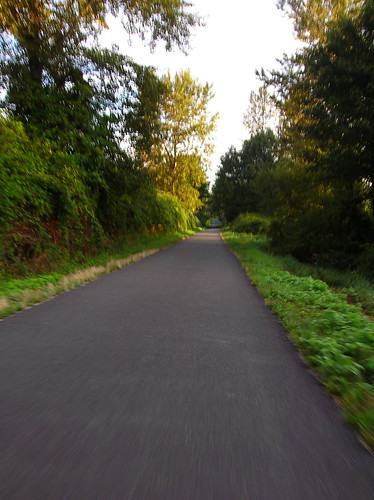
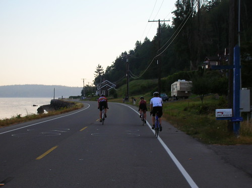
A few pacelines passed eventually, and I just let them go. Once we were off of 410, it was small country roads for the next 50 miles or so. Great views, low traffic, what else can you ask for?
Eatonville
33 miles or so into the Ramrod, and 71 miles on the legs so far. There was a rest stop here, where I overheard motivating terms like "sweep van" and "lanterne rouge" - sure signs I was near the back of the pack. Only problem with that is if you go too slow, they pick you up and cart you off! Gotta be tough to have that happen.. and I would have physically fought them off anyway, had they tried to pull me into the van.
And from looking at the photos from Eatonville (lower left corner) I was fourth from last in the pack of 800+! No wonder I saw so few riders in the beginning.
Eatonville to Longmire
Passed by a few resort/hotels, and noticed how sparse services are out there! Doing this route as a permanent seems kind of daunting. You'd have to do some looong stretches with no available food or water. I guess there were some restaurants along the way, but still. Not a ride for the easy going, to do it unsupported.
In Elbe I stopped for water, and in talking to the shop keepers and her friends, they seemed disappointed I was just from Seattle, as "everyone we've met so far are from the area, but we hear people come from all over the world for this ride." Hey, I do what I can. They were nice though, and probably happy to have the extra business.
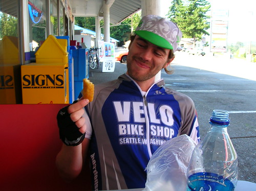
At the food stop at mile 59, I upped the water & got a half-bagel, grapes, a few other random things. In talking to one of the volunteers, I mentioned how I rode to the ride - and I have to admit, though it may be obvious, that one of the reasons I rode to the ride was for bragging rights. Getting a response I could only hope for, she called over friends, announcing my brave achievement! Noticing my SIR jersey, one of them mentioned that he rides with SIR, and has done the PBP last year! I think Shane was his name, nice guy.
He also commented that I'd caught up with the pack more or less, which was good news. I spent probably 15 minutes or so here, and rolled out alone. Coming into the Rainier National Park, I was excited to have the climbing begin. The last time I was in this area, Cayuse Pass kicked my ass. This time I wanted to turn the table.
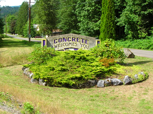
Rainier National Park
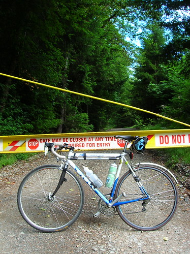
Entering the park you're asked for your number by a volunteer, as being on the ride is your ticket for entry. I wonder how they react to bandits (those that do the ride but don't pay) here? Or if someone was touring the world, and happened to pass through here at the same time, would they let them through?
The road tilted up more and more, but never got too steep, maybe 5-6%. Passing more and more riders, I felt better that I was at least somewhere closer to the middle of the pack by now. The views were getting better and better, with Rainier sticking out behind trees and getting what seemed closer with each turn of the road.
Longmire
This is where the harder climbing started, and was about 60 miles into Ramrod, 100 miles for me. Not much worse than 5-6%, but it surely went on for a while. A gigantic tour bus passed me, and somehow passed me again later on. I hoped that I was getting a better experience on the bike, than in an air-conditioned bus - well at least I felt like I was really "earning" it anyway.
Inspiration Point
After an hour or so of sustained climbing, I made it to the "top." I guess the Paradise climb adds six miles, but our route didn't take us there for some reason. (We went right at the fork) Next time through there, I'll do the extra trip too.
At the top I saw Dan T, another randonneur who I'd ridden with on the failed 600k in June. He was in good spirits as usual, and it was nice to see a familiar face. I only spent about five minutes here, got some water, and enjoyed the hell out of the screaming descent. 60 km/h (~40 mph) was fun, and there was no winds to mess with you. Little drainage grates that span the road made for some careful crossings, but at that speed you're barely touching them anyway.
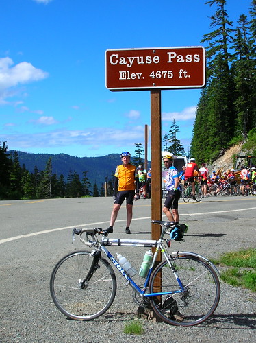
The next climb, Backbone Ridge, seemed more like a hill than a pass. Well I guess it's not a pass, just something we had to cross to get to the next big climb, Cayuse. Caught up with lots more riders here.
Cayuse Pass?
I didn't even realize we were on it, and in a discussion with another rider, I said I didn't think it was it. For some reason it looked different, and seemed less steep. The difference was a relief from last time, when it seemed like a wall and that I was on a 100lb bike. I pictured getting there and just grinding to a stop.
But my new 12-27 cassette was the perfect gearing it seemed. Also the lower weight of the Ciocc, and the lighter load, made a huge difference. And on the Miyata I've got a low gear of 39x30 (which should be easier in theory)! Weight does matter, at least for me. Then again it was also about 300 miles and 30 hours into the ride last time. Anything can seem impossible at that point.
At about 3:30 or 4:00 PM I crested Cayuse, glad to be done with it. Some day I'll hit up Chinook Pass too - you can see it from Cayuse and it looks like a real exclamation point to an already-hard climb.
The Deli Stop
At the Deli Stop, 118 miles into Ramrod, 146 miles on my legs - free sandwiches, fruit, etc. Only there was no bread at first. That's one thing of being near the back of the pack, supplies run out. I had a few slices of cheese, some fruit, and a soda. Sat in the shade, and tried to soak in everything I'd seen up to this point. Eventually bread did show and I had a sandwich - thanks volunteers!
With lots of riders swarming around, I was looking for familiar faces - Jessie was somewhere on this ride, but probably way ahead of me. One guy stopped me and was asking if I rode to the ride - said he saw me on the road at 4:15 this morning and thought, "no way he's riding to the ride!" Once again I was glad to get to talk about the extra mileage I'd tacked on. He was impressed, but I reassured him that I could never hold the fast pace for ~40 miles that racers like him do.
Eventually I ran into Joe from SIR - it was nice to see another blue wool jersey out on the road! I spent probably 30-45 minutes here, but at this point (~4 PM) I was pretty safe from being "swept" up. Time to spare. We chatted for a while, probably both happy to see someone that understood what those funny-looking lights and bags were hanging from our bikes.
Now the only question was, how early do I want to get home? I told Kira I'd be home some time between 9 and 2 AM, quite the range - but you never know how a long ride is gonna go. Leaving the deli stop, I was on enjoying the slight downhill towards Greenwater, thinking about how I'd flatted/broke my pump not far from here and
ended my 600k in June. This time I rolled through without a hitch.
Greenwater And Beyond
I was holding a good 30-40 km/h (19-25 mph) solo, just wanting to get to the ice cream waiting at the end. Held even faster speeds with one quick paceline, but ducked out after a mile or so, not really enjoying the tension that is a paceline. Are they gonna brake suddenly? Will I do something stupid and bring it all down? If I'm leading, am I going too fast or too slow? Pacelines are too complicated, plus they don't allow for much sight-seeing.
Also I knew I needed to save some energy for the commute back to Seattle, nobody wants to blow up on the road 30 miles from home without a cell phone.
After passing Greenwater without stopping, I continued on for what seemed like forever, before I hit the left on to Mud Mountain Road. Finally, a change of scenery. On the super-steep downhill, I hit a good 60-70 km/h, and pedaled through the turns, praying for no gravel to bring me down. It was a blast!
At the bottom I ran into Joe from SIR again, and we rode side by side in our matching SIR jerseys, chatting and enjoying the fact that we were almost done.
Finished, for now
And at 6:15 or so, we were done! We rolled in to the cheers & claps of volunteers and onlookers, and received our free patches. Ice cream was quickly acquired, and a cola was downed. The world rejoiced.
I went to get a free t-shirt, and as I walked up the volunteer asked, "are you the one who rode to the ride?" Guess news travels fast! It turns out her friend was injured on the ride, and they needed someone to drive the car back. I would have done it, but as it turns out I don't actually have a driver's license (mine expired a few years ago), so I couldn't do it. Hope her friend was OK though!
Enumclaw Back To Seattle
At about 7 PM I started the journey back to Seattle, feeling oddly fresh. Turning the cranks seemed like something I could do all day, as if I'd turned into a machine that's perfected perpetual motion. There were some steep sections of Highway 169 north of Enumclaw, posted at 8%. No problem for the 39x27, but I certainly wasn't doing those in the big ring.
Five or six cars carrying bikes gave a congratulatory "honk honk" as they passed, probably recognizing the neon sash and rear light from the ride. I waived and wondered what time I'd make it home.
About 10 minutes after rolling out a light rain started. No prob, this is why I threw on the "race blade" before I left the house! The ride to Renton was pretty much a breeze, with the light rain still falling. Passed through Black Diamond, Maple Valley, without even wanting to top, I just wanted a warm couch to sit on at that point.
The "scary" section of 169 was a little iffy coming into Renton, but most cares provided space - after all it's a four lane road.. one car did buzz me a bit, but I kept rolling so it's all good.
For the first time that day I was feeling very hungry, but I trudged on, my feet starting to get very cold from the thickening rain. I thought about how if this was a 400k, I could do the Mercer Island loop to top it off. Would make for an interesting brevet or permanent, who's with me?
It felt really, really good to be home, and dry my feet off. A warm shower at the end of a big ride is always a nice way to end it. And not at 2 AM like it could have been had I take more stopping time or had a mechanical.
It was a great ride, but next year I'll probably just do it as a permanent or even just for kicks. And now that I know a bunch of randonneurs, it shouldn't be too hard to talk someone else into doing the ride starting from Seattle. I think it was well worth it, and now every time I look at Mt Rainier I'll know exactly what it takes to get around it!
Ride Stats:
Distance: 38 + 154 + 38 = 230 mi (370 km)
Start Time: 3:15 AM
End Time: 9:55 PM
Ramrod Start: 6:15 AM
Ramrod End: 6:10 PM
Passes: Two real ones (Climb to inspiration Point, Cayuse Pass), one smaller hill (Backbone Ridge)
Edit: stumbled across the results from 1998 - times range from 7 hours 14 minutes (whoa), to 13 hours and some change! ~7 hours sounds ridiculous. Not surprisingly, looks like Jan Heine posted a time of 7 hours 18 minutes.
Edit #2: A note about age. Ramrod numbers are assigned based on age: the oldest rider is wearing "1" and highest number I saw was about 850. Mine was 805 - so most of the numbers I saw were of people that are older than me! And to think I've been feeling "old" having turned 30 lately.. We got to see #1 cross the finish line, only a half an hour behind me & Joe. I hope I'm that good on a bike 40 years from now!


