Saturday, May 31, 2008

Getting Ready For A Gigantic Ride: The Four Pass 600k Brevet Preview

Just trying to digest the ride coming up in a week: 600km (375 miles), four mountain passes, under 40 hours. [link] Or over 40 hours, but no "official" credit for the ride - which wouldn't be altogether a failure, either way this ride will make for a great story.


Below is a map of the route - that's Seattle in the upper-left corner, and Yakima in the lower-right! And also you can see Mt. Rainier in the lower-left there. Wow. The scale of this ride is hard to comprehend, but the other brevets leading up to this have prepared me well. [full map]


The elevation profile of this 600k, from the RUSA64 blog - max height is 4,868 feet or 1,483 meters:


Everyone preparing for this ride is probably thinking, "how long will this take?" That's different for all of us of course, but here's a few guesses as to how I'll do based on previous ride stats:

Previous finishing times, in HH:MM format:
March 3rd Urban Populaire 100k: 5:50
March 15th 200k: 12:45 (disqualified, got lost, missed a control in time!)
March 29th 300k: 19:20?
May 5th 300k: 13:20
May 17th 400k: 19:36 (Three Mountain Passes)
Rough predictions of ETAs and finish times:

  • (ride to the ride, leave home at 3 AM - only 22.5 km (~14 miles) to get there)
  • start in Issaquah 5 AM 6/7
  • 200k 2 PM (9 hours, roughly in Leavenworth or just past it)
  • 278k 6-7 PM Ellensburg, a little less than half way
  • 400k 11PM-12 AM (9-10 hours, this is roughly the Rimrock Lake area, a possible sleep-spot)
  • 600k 11AM 6/8 11 hours, back in Issaquah
  • (ride home from Issaquah, probably at 10 km/h - 4 hours or 3-5 PM Sunday 6/8)
So about 30-36 hours or so - that's about a day and a half! Possibly without sleep, which is something I need to decide soon. The RUSA handbook says that riders hoping to complete a 1200k should try a sleepless 600k at some point, but I'm not sure if I can swing that. At worst I'll bring a bivy sack and light sleeping bag, and possibly sleep in a soft ditch somewhere. We'll see.

Random tidbits about 600k's - here and elsewhere:
  • Mark Thomas has recently pre-ridden this year's route and written a moving preview
  • Average time on last year's 600k: 31 hours 32 minutes (not a mountain brevet I believe)
  • This rider's account of a davis, ca-area 600k - an interesting read
  • Kent Peterson's story of the 2002 SiR 600k four pass brevet - the same one as this year but in reverse. And if you see a pile of rocks keeping chocolate milk cool in the shade on the side of a road, it just might be placed there by the ride support! Who would have guessed?

Today (Sunday) I went out for a 77km spin: Seattle to Renton via Lake Wa Blvd, then Renton to Issaquah via Highway 900/Sunset Road, then Cougar Mtn summit, then back to Seattle. Not a huge ride, but I figure I needed to pack in all the climbing I can before the Big Day. The legs felt pretty good, and I even "sprinted," or tried to, going up Cougar. I hit 30 km/h (~18 mph) ona false-flat part, and it took about 25 minutes to make it all the way up. It's hard to compare this to a mountain pass, but I think I'm ready!

Update: you can read how the ride went here.

Wednesday, May 28, 2008

Veloroutes.org In The Washington Post!

Last year I was contacted by a freelance reporter working for the Washington Post, who wanted to do a story about cycling, hills, and online mapping. Lucky for me, she picked veloroutes.org out of the many mapping tools available!

I thought it wasn't going to run after all, since it had been so long. But yesterday the story was finally published! While it's not all about me & veloroutes, we do get a plug towards the bottom!

"It's not just mapping experts who rely on high-tech tools to figure out where to ride. Matt Mikul, a 30-year-old Seattle software engineer with a gears-are-for-sissies approach to cycling, wanted to gauge some of his area's formidable hills before attempting to ride them on his fixed-gear bike. With the help of data from Google Maps, the U.S. Geological Survey and a bit of calculus, he designed a hybrid application -- what Web designers call a mash-up -- that automatically calculates the steepness of a hill and creates a profile of the entire route. The self-styled tool he named Veloroutes and posted to the Web two years ago ( http://www.veloroutes.org) has been averaging about 10,000 users per month."

(I'm actually not quite yet thirty, and I haven't touched my fixed-gear bike for a few months... so the whole "gears are for sissies" part wasn't from me.. but I'll take the link nonetheless!)

Big thanks to the Washington Post for the article!

Monday, May 26, 2008

Hills Of Kirkland Century: Ride Report

The "7 Hills of Kirkland" ride was today, and I did the century option - gotta keep the legs fresh for the 600km brevet in June!

The century route went like this, in a figure-eight of sorts:


And the elevation profile - just look at all those ups n' downs! Max elevation was only 600 feet or so, nothing major. But of course the shorter the climb, the steeper it usually is.

Long story short, I accidentally skipped part of the route (the Winery Hill portion) for a grand total of 145 km (~85 mi), but the 27 km (~17 mi) journey to the ride via I-90, and the 10km (~6 mi) ride back over 520 made it a century day nonetheless.


It was a great ride, and I held a good pace the whole time - averaged 27.1 km/h (~16.9 mph) over the entire course. While I had my cue sheet taped to my handlebars, a rando habit, I soon realized that all the "Dan Henry" marks on the ground meant I didn't need it! What a difference those make; brevets would be lots easier with them, but at the same time they'd take away from the challenge rando's are looking for.

I tried a new approach on this ride, which was to stay on the bike as much as possible. To that end, I skipped the first two rest/food stops, and only stopped twice, for maybe 15 minutes off the bike the whole time. (One pee break in Carnation, and a food/water stop at the 50mi point).

By staying on the bike I was being passed by pacelines, then passing them as they rested. Then they'd pass me again. Not sure how it all turned out - I mean it wasn't a race, but these are the things I pay attention to.

Photos from the ride to the ride, and the ride itself

The view east before heading out - you can barely see the base of the Space Needle, but not the rest of it. Just fog though, no rain, and I'm gambling that it won't (e.g. not bringing a rain jacket).


My Ciocc, ready to take me where I want to go - Kirkland. Land of the SUV and latte-in-hand.


Rolling through the Central District, this is more or less my commute route too (Jefferson St).


Only a cyclist could love a shot like this - everyone else probably thinks this shot is pointless.


Now on the I-90 bridge/bike path, about to be in Bellevue. Don't be fooled by the serenity of the scene - there's 10+ lanes of Interstate traffic behind me, it's really loud!


Downtown Bellevue - I'm really glad I don't work here anymore, it's generally a Boring Place.

I had Bellevue Way more or less to myself - which is nice because in a few hours there'll be a sea of cars on this road!


Arriving in Kirkland at the start of the ride - lots of bikes, nobody I know though. But we're all on the same tighly-clothed team!


This was in ? heading to ? - not sure where exactly this was but it was the century & metric century break-off point. It was even better-looking than this pic.


Now on one of those backroads in Carnation - it kind of looks like it's raining in this pic, but I think that was sweat on the camera lens.


Again I'm not sure where this one was, but doesn't that look familiar?! Seems like the roads in the Kirkland-Carnation-Duvall-PNW area all look the same - lovely. Who needs a shoulder when there's barely any traffic anyway?


Now back in Seattle, a few blocks from home.


Total Distance: 27 km to K'land, 145 km on the ride, 10 km back = 182 km (113 mi)
Total Time on the 7 Hills Course: 7:50 A.M. to 1:30 P.M. = 5 hours, 40 minutes (5:25 rolling time)
Average Speed: 27.1 km/h (16.8 mph)
Food eaten: Two Payday bars, one snickers, two "Sweet & Salty" bars from Kellogg, some fig newtons, two cookies, two bananas (not a lot, but enough)

Sunday, May 25, 2008

Abandoned, WA

Cyclists often run across old and decrepit on their adventures out of town. For instance, along the 400k Three Pass brevet route we passed a number of jems just of the highway - some probably didn't even notice, most were too tired to care.

So on that note, here's a great blog just started by a very good friend of mine - Abandoned, WA.

So from now on I'll be keeping an eye peeled for down-trodden and forgotten homes, shacks, etc. Who knows what's behind the next bend in the road?

Bainbridge & Mercer Island Loops with Friends

Yesterday I set out for the 10:30 A.M. ferry to Bainbridge Island - a nice break from the 5 A.M. start time on last week's 400k brevet.. this would be a day of leisurely riding over short distances.

Got to the ferry in time, found Robert, Chris, and Joby waiting. Robert bailed and went home (dude. you missed out!), and we bought our tickets and boarded the boat for the island. On the ferry we found Rachael & her friend Heidi, two Group Health racers that were also doing the loop - sweet, we've got a peloton of five!

The plan was to do at least one 32-mile (~53 km) "Chilly Hilly" loop, something I've always wanted to do. Yeah Cascade does the organized ride each February, but I'm not about to pay anything to ride 50 kilometers! No wonder .83 organizes the yearly "Fucking Hills Race" on the same day, I might go for that next year.


Anyway we more or less did the loop, getting lost a few times. Not sure if we skipped the monster climbs, because nothing really seemed all that bad. Maybe 7% for 1/2 mile, but that's something you can find in the city anyway. We tried to follow the "Dan Henry" markings but they seemed to send us in different directions than the cue sheet - my theory is that the cue had an incorrect marking for the turn on to Lynnwood drive.

Oh yeah and we saw "Frog Rock" - you be the judge if this looks like a frog to you: (image source)


After the loop we got on the ferry back to Seattle - once there Heidi took off for home, as did Chris & Joby. Dennis met up with Rachael & I and the three of us headed through downtown towards the I-90 bike trail out to Mercer Island. More riding, sweet!

Mercer Island seems to be smaller than Bainbridge, but doesn't have the "small town" feeling that Bainbridge sometimes provides. Mercer is more like houses centered around a small strip-mall. Yuck.

But the Mercer Island Loop is great! Only 13 or so miles around, but curvy two-lane roads that cyclists drool over. We banged it out at a 20 mph (32 km/h) pace - nice work, team!
Total Distance: 95 km (59 mi)
Total Rolling Time: 3:59:00

Tuesday, May 20, 2008

SiR Three-Pass 400k Results w/ Pics

Here are some photos snatched from the SiR flickr page & Robert's flickr page.


One of my favorite shots from the ride - a small peloton rolling up I-90:

Chris G. going over Stevens Pass, looking like a pro 100+ miles into the adventure:
Here I am rolling into the secret control, after climbing some nasty 17% (or so) short hills (and three passes and 200 miles!). Check out the front-mounted water bottle - I think it saved me a few times on this ride. At this point it was filled with Co'Cola, the original energy drink.
The look of a tired, but determined randonneur - ready to get this thing over with! Somehow stuffing bread & cheese down - it really hit the spot. Thanks, Thai!
At another control in Paradise Lake - more water?! You bet. And, yes, that's a sun burned arm! They don't look so dark-pink anymore. Btw that's RUSA's very own Mark Thomas, looking presidential in the background, residing over the control. He knows what we've been through, he did it last week!

OK, I know this is pretty nerdy (I'm kind of an engineer after all) but here is a graph of the sorted finishing times - the first to finish on the left, and the last to finish on the right. Click for more detail.

Official results posted here. But here are the results sorted by time, you know you want to see 'em!

Although I should add the disclaimer that official rando results are sorted by name for a reason - all finishing riders are respected equally, and there is no special medal or award for "first" place. In randonneurring, the whole point is to finish the route within the specified time limit (27 hours in this case).

Ragsdale, Chris 13:51:00
Koenig, Urs 13:51:00
Beeson, Peter 15:17:00
Kantner, Kole 15:40:00
Heine, Jan 15:52:00
Ryan, Jim 15:52:00
Ohlemeier, Brian 16:51:00
Sikorski, Vincent 16:53:00
Brudvik, Bob 17:31:00
Roehrig, Mark 17:31:00
McHale, Mike 17:31:00
Hamilton, Ryan 17:58:00
McKee, James 18:20:00
White, Charles 18:20:00
Ahlvin, Eric 18:20:00
Methner, Wayne 18:36:00
Roberts, David 18:36:00
Humphreys, Kevin 19:05:00
Carter, Ken 19:34:00
Mikul, Matt 19:36:00
Muoneke, Vincent 19:36:00
Swarts, Geoff 19:45:00
Beebe, Ward 19:52:00
Shopland, Ian 20:06:00
Smith, Gary 20:40:00
Morse, Josh 20:40:00
Boxer, Daniel 20:40:00
Gay, Christopher 20:47:00
Higdon, Robert 20:48:00
Andersen, Erik 20:55:00
Nguyen, Thai 20:55:00
Chang, Jennifer 20:59:00
Blachon, Domenique 20:59:00
Loomis, Jeff 21:04:00
Haight, Rick 21:09:00
Norman, Michael 21:34:00
Sprague, James 21:36:00
Leahy, Pat 21:41:00
Blacker, Rick 21:46:00
Perera, Shan 21:49:00
Lagasca, Robert 21:49:00
Chow, Galvin 21:49:00
Platzner, Joe 22:31:00
Davis, Steve 22:53:00
Knowles, Martin 22:55:00
Teeter, Dan 22:58:00
Huber, Michael 23:10:00
Ringkvist, Victor 23:10:00
Tilden, Brad 23:36:00
Larson, Lesli 23:38:00
Winczewski, Peg 23:38:00
Whitney, Paul 23:38:00
Nussbaum, Ralph 23:54:00*
Boothby, Donald 23:54:00*
Thomas, Mark 23:58:00
Krishnamoorthy, Narayan 25:28:00
Tilden, Jeff 25:28:00
Alsup, Bill 26:52:00
Nowlis, Suzanne DNF
Black, Todd DNF
Smith, Donald DNF
McFall, Ray DNF
Harper, David DNF

* = possibly an error

Sunday, May 18, 2008

Seattle Rando's May 2008 400k - Three Pass Ride Report

Climbing Snoqualmie, Blewett, and Stevens, plus more in one day was a 249-mile (400km) adventure. The fastest riders did it in 14 or so hours. See previous entries for photos of this route, as well as a route profile & map.


5:03 A.M. Start control, North Bend - I was walking into the bathroom at the hotel when I saw the peloton outside roll out. Dammit! Chris & Robert waited for me, thanks guys.

5:15 A.M. My first time riding on the Interstate (I-90 in this case), and it's not so bad. The most jarring part is the noise, with large pickups towing cargo that were easily the loudest vehicles it seemed.


The other jarring thing about the Interstate is oversized trucks carrying large houses or in this case large cubes wrapped in black. Even with those things five or six feet away (if not more), when it passed you get pushed to the right by the large vehicle's air-displacement. But we only had a few of those go by.

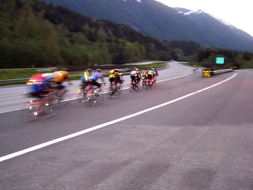
6:00 A.M. Chris G., Robert and I caught up with the main pack of riders - easy to spot with 30 or so blinking lights and all the reflective gear. We passed a group of 10-15 riders, and then caught up with 20 or so more.

There seemed to be spots of cold followed by warm spots, and the temps were easily in the upper thirties! My short-sleeved wool jersey + arm warmers were plenty, even with just shorts on. Although my fingers & toes were freezing! But the up-close views of snow-covered peaks were worth it.

Then I wanted to see just how fast I could do the climb, so I stood, shifted up, and accelerated to 25-28 km/hr or so, after climbing at 20 km/h for the first few miles of the climb.

6:30 A.M. Snoqualmie Summit Reached the West Summit quicker than expected! It wasn't too steep, probably just 5% or so. I wouldn't say this climb is necessarily easy, but it was the easiest of the day. It was a great feeling to see the road finally turn down and offer not a chance to rest, but a chance to go faster!

I was actually surprised that the most I was hitting was 50-60 km/h (30-35 mph), but it was still fun to cover lots of ground at once.

7:00 A.M. The end of the big lake I raced at 40 km/h past the big lake at the summit, and finally caught up with what seemed to be the front group. (Actually Chris Ragsdale, Jan Heine, Urs Koenig, and others were probably doing 50 km/h on the flat sections of I-90.) I was happy to reach them, and just sat on Bob Brudvick(?)'s wheel for a while. I had burned a few matches catching up, after all!

Bob flatted and a guy with a mustache (thanks for pulling!) and I kept on truckin, pulling at 32-40 km/h on the flats around Easton (I think that's were we were). The bridge with no shoulder was fine, and a big-rig even pulled over to the left lane to give us room to pass. You just gotta watch your back going through there!

7:55 A.M. Control #2 in Cle Elum - enjoyed some chocolate milk and snacks at the gas station and got my brevet card signed, and headed on. Probably spent 10 minutes or so here. By the way, Payday candy bars of one of my new favorite riding foods (it's the one with caramel & peanuts).

The flat section before the Blewett climb (this is on Highway 97 heading north) was quickly over, and the climb began. I was keeping a 25 km/h (~15 mph) pace, so it wasn't too steep - just a lot of up. A rider passed me at maybe 28-30 km/h, and it was all I could do to hold his wheel.

After maybe 5 km of that I let go, watched him disappear into the forest of concrete & trees.

10:00 A.M. Blewett Pass Summit - I think this was about 100 km into the ride. It wasn't too bad, but it took quit a long time and a lot of energy. The last few km's of it were steeper than the rest, and made me glad that I'd switched from an 11-23 in the rear to an 11-25. Also glad I'd dropped the big Carradice bag in favor of stuffing my pockets with tools and everything else I needed.

Luckily two volunteers happily served snacks & water at the top, and said that the "leaders" had passed through there at 9:20 A.M., just 40 minutes earlier. Not that I think I could catch up to them, or that I could hold their wheel even if I did, but I was happy to be keeping good time.

I waited a little while to see if Chris & Robert were coming up any time soon, but after 10 or 15 minutes I bombed down the 30 km or so descent. Again nothing really over 50-60 km/h, but still fun. More great scenery, but now showing rock faces & desert-like plants in addition to snow-capped peaks.

11:20 A.M. Leavenworth Control - ate one of the two black bean, rice & cheese burritos Kira was nice enough to make for the ride. It really hit the spot, thanks baby! Bought more food, V-8 juice, and water. Having a third water bottle mounted on the handlebars was great, even if it took away some hand positions. I never ran out of water, even with 80 km in between some of the populated (e.g. at least having a convenience store) between some of the controls.

It's at least 95F degrees by the point, and I heard someone say "100" and I believe it. I didn't wear sun-screen, but even though I wanted to get a little sun I ended up getting doused by it all day and was more or less burnt by this point.

1:00 P.M. Heading up Stevens Pass - Chugging along up Highway 2 heading west, and caught up with the group that left the control a few minutes before me. We pacelined for 10 km or so, then stopped for water at a rest stop. At this point I'm really fucking hot, but at the same time I'm glad I'm not cold. Cold hurts, hot is just uncomfortable.

After too long at the rest stop (maybe 20-25 minutes), lots of water, and some time with the shoes off (ahh, that felt good!), I was off again. Saw a sign that said 19 miles (~30 km) to Stevens Pass, presumably to the top of it. Well, no choice but to continue! The great views await.

Periodic waterfalls let of cool air that felt great - I stopped in front of a few of them and enjoyed the "air conditioning."

2:00 P.M. Not there yet, but still turning those pedals. Snow lines the side of the road, and it's much cooler now at ~2k feet of elevation.

3:20 P.M. Summit at Stevens - 220km into the ride, just about halfway. The last 5 or 6 km were steeper than the rest, but my 39x25 tackled it fine. I didn't stop, just switching to the 53-tooth ring and got in the drops for a big descent.

I took the lane since those big drainage grates take up most of the shoulder, and kept a 60 km/h (40 mph) pace. I could sprint up to 67 km/h or so, but couldn't seem to even break 70! There must have been a headwind.

The views are epic, and the sky is clear, showing all of the snow-covered peaks surrounding you. I saw a guy walking a bicycle (w/ trailer, no less) up the last section of Stevens coming up the other way - ouch. I think going the other direction would be much harder, I felt bad for that guy but I had a descent to enjoy!

4:20 P.M. At the 3rd control in Skykomish - Skykomish is apparently made up of lots of trees, a road, and a gas station. But what a welcome sight! More water consumed, and some snacks to boot. Getting ready for a long stretch of Highway 2 that won't be fun.

This stretch features a few bridges sans shoulder, and shoulders that got as small as about 2 inches. Cars were giving me plenty of space though. This was a boring section, especially alone. But again, the views (of moss-covered trees) were amazing.

I ran over a snake somewhere in this section - I saw it, but thought it was already dead, so I didn't swerve around it. It was a little 1-foot black snake, coiled up. After bumping over it, I looked back and saw it slither back into the brush! Oops, sorry snake.

6:00 P.M. McDonald's in Sultan - actually I'm not sure what time I got there, but I made the mistake of getting a whole, super-sized, value meal here. Well I guess I just needed some real food - sure, this wasn't real food, but it would do for now! A coke with ice never tasted so good.

6:20 P.M. Sultan - Vincent & I rolled out from the Mc'd's, and (finally!) took the turn off of Highway 2 on to Old Owens Rd for some rolling hills. Sure enough, not long after that turn we encountered the first of many steep sections. At this point I'm pretty tired, and my hands are killing me.

(I used some new gloves on this ride, but they don't have good padding. My right pinkie & ring fingers are kind of numb! Hope that goes away. Also used some different shorts than the usual knickers, but these old shorts have next-to-no padding - mistake!)

~8:30 Secret Control just off Dubuque Road - Vincent and I were really tired at this point, but continued on. Some cheese & bread, water, really hit the spot here. Thanks to the volunteers for running this!

~9:00 P.M. Control in Paradise Lake - Mark Thomas happily gave us water and encouragement. At this point I thought I'd left my control card at the secret control, remembering I never got it back from the volunteer!

Mark made a call to the secret control, to see if it was there. It was not. A few minutes later, and Vincent pulls it out of his pocket! Guess he'd had it for the last hour or so, thanks Vince! That was really relieving. Even though this isn't a PBP year I still want credit for all this suffering.

10 P.M. almost in Carnation(?) - this section seemed to go on forever, and at this point I'm definitely ready for the ride to be over. But there's still more road to cover. The moon was almost full, but didn't seem to light up anything really. Or maybe I was just in that negative mode that happens when you run out of stamina and motivation.

12:20 P.M. Final control in North Bend - finally back where we started, 20 hours and about 20 minutes from when we'd started. That last section of road seemed like it went on forever!

Brian was at the finish line, along with a few rando's that had finished earlier - some of which is was ahead of for lots of the ride, but in the tradition of the tortoise and the hare, I went too fast out of the gate and paid for it at the end.

The pizza & drinks were great, although I for some reason had the hiccups and my stomach felt a little queezy. It was probably that #3 from McDonald's that was not helping me at this point.

Thanks to all the organizers & volunteers, and thanks a mil to Robert & family for the ride! This wouldn't have been possible without you. See you on the 600k!

Edit: Robert posted some great pics from the ride on his flickr account - thanks dude!

Tuesday, May 13, 2008

Three-Pass 400k - More Preview Stuff

If you can't tell by now, I like to learn as much as possible about a route before tackling it. And the three-pass 400k coming up this Saturday is no exception!

Here's what the elevation profile looks like, as clicked out by SiR's very own Joby D:

And here is the map of the route - North Bend to Cle Elum, to Leavenworth, To Skykomish, Snohomish, and back to North Bend - 400km of pain!

Here's the interactive version of this route on veloroutes.org. (Btw it estimates 24k+ feet of climbing, which must be grossly overstated. On Mark's blog he mentions 13k feet of gain, and that sounds much more reasonable, but still no walk in the park.

Besides the climbing, I think the most challenging part of this ride will be food. Or rather, the lack of it. There just aren't that many corner-stores up in these mountains, so we'll have to plan ahead when we do get a chance to re-fuel.

To that end, Mark sent a mail to the SiR e-mail list with good info about rest-stops along the way, copy-pasted here:

North Bend - Cle Elum (mile 50)Mile 18. Snoqualmie Summit. Convenience store.
Take first exit (West Summit) and head to the right.Around mile 36. I think
there are services at Exit 70, but some backtracking is required, if I recall
correctly.


Cle Elum - Leavenworth (mile 103)Mile 64. Liberty Cafe on left.
Pie! Espresso stand. I didn't stop this year, but they are usually friendly.
Less so a the Mineral Springs resort a couple miles further on the right.Mile
85-90. Camp store on the right after most of the downhill


Leavenworth - Skykomish (mile 153) Mile 118. Coles Corner. Diner, convenience store, and coffee
stand on left.Mile 121. Nason Creek rest area. Last water for the long climb up
Stevens. Usually has a volunteer group with coffee, drinks, and cookies.
(Homemade banana bread last weekend).


Skykomish - Maltby (mile 213)Mile 160.
Baring Store on the left. Nice people, good sandwiches, soup, but too soon past
Skykomish.A few miles past Baring is the Mt. Index espresso stand. My favorite
place for coffee on US-2.Mile 173. Gold Bar - grocery store on right and other
servicesMile 178 or so. Multiple services in Sultan. McDonalds and Subway on
right before you get to town. Vinaccio Coffee and a mexican restaurant on the
right in town. Convenience store at turn to Old Owen Road.Mile 204. 24hour 7-11
in Snohomish.


Maltby - North Bend (mile 250)Mile 233. Carnation. Shell
station claims to be open 24/7 ("Unless somebody doesn't show up").Mile 238. The
route goes east on 202. If you go west instead, into Fall City, I think there is
a convenience store just on the other side of the river.

Also another pre-ride report is available here.

I can't wait!! See you on the pass...

Monday, May 12, 2008

Three Pass Photo Preview - Part 2

Here are some more photos I snapped this weekend on our car trip our to Twisp/Winthrop.
Another view of the I-90 shoulder at Keechelus Lake - no line, but there's a rumble-strip at least:

On the way up Blewet there's this crazy little shack-looking thing - all rusty inside, looks like a large pipe inside actually. We stopped to get a close up of the thing, but you can see this from the road, it's on the left.


Close to the mine shaft thingy is this abandoned house in Liberty, an old mining town of 10 or so houses. We'll see Liberty Road on the way up Blewett, and this is what it has to offer:

Blewett actually has a great shoulder the whole way up and down, it seemed. And great views too!

There's another abandoned place just off 97 that you can see on the left - we stopped and checked it out - it even had bones in the yard! More great photos of abandoned stuff we found along the way (and the bones) on flickr.


Didn't realize it at the time, but this was probably a SiR rider doing the pre-ride! Heading up the big "hill":


More of 97, going up:

The summit at Blewett - 4102 ft/1250 m - wow. Just before this peak there's a ~1-mile stretch that looks much steeper than the rest. That'll be tough, but rewarding for sure.


Now the fun part - downhill! Get ready for 30 or so miles of this - perhaps I can finally hit 100km/h out here?


I believe this was SiR's very own Mark Thomas, enjoying the descent down Blewett.

More great views, still going down Blewett - this side of it seems much steeper - seems like this route in reverse would be even harder!

Coming down (or was it up?) Stevens Pass - lots of snow, but the roads were bare & wet:

This was coming down Stevens, close to the summit. The clouds/mist made it look like the end of the earth was just around the corner. There was a light snow/wintry mix coming down - would make the descent cold! Actually the air seemed much colder atop Stevens than the other two passes.

Now at the more-or-less bottom of Stevens, on Highway 2. This tunnel is short, but will still take a careful cyclist to make it through unscathed.

I took a bunch more photos, but these were the highlights. This weekend's forecase is sunny & warm (hot even!)

Preview of the Three-Pass Ride - Part 1

I got a chance to go to the Twisp/Winthrop area over the weekend, and we drove (actually Kira did the driving, thanks!) and in the process we got to see a preview of the upcoming three-pass 400k on Saturday 5/17.
Here are a few photos I snapped along the way, starting in about North Bend.
We're gonna pass through those mountains on bicycles! Can't wait.

Getting up there on Snoqualmie, starting to see snow on the ground - didn't feel all that cold though.


In the distance:


I don't see a line indication a shoulder, but I think/hope there are rumble-strips on this section: (close to the pass)


Top of Snoqualmie Pass, 3022 ft/921 m


I can't believe I'm gonna ride through this! This is a nasty (looking) section just after the summit.


That big lake (Hyak I think) at the top:

The "Snow Hut" or whatever it's called - that would just about ruin any West-bound trips on this road by bicycle I'd think (no shoulder!)

The Lake:

A scary bridge to cross just before Cle Elum I believe - there's a detour around this btw:

I took pics of Blewett & Stevens too, I'll post those up here before the big day.

Thursday, May 8, 2008

A Critical Mass of One?

Local news reports a cyclist on I-5, clogging up traffic and trying to get on the HOV lane! Meaning he had to cross 5+ lanes of 60+ mph traffic, wow.

From the report:

Witnesses told the State Patrol that they saw the man riding south in the
right lane about 2:10 p.m. The bicyclist then cut across all lanes of traffic
and into the car-pool lane, said Trooper Curt Boyle. Motorists pulled over,
stopped the man and held him for troopers.

When troopers arrived, they got into a scuffle with the man, Boyle
said. The man was being detained in handcuffs in the back of a squad car on
Interstate 5 near Northeast 130th Street but has since been taken to Harborview
Medical Center for a mental evaluation, Boyle said.

Monday, May 5, 2008

Photos From the 300k Brevet

5:30 A.M. - Downtown is looking dry. Sweet. Gotta catch a ferry somewhere behind that forest of buildings.

~6:01 A.M. - I came so close to missing the ferry it wasn't funny. And when I told the toll-booth lady what the ride was, and when I expected to finish (~10 PM), she looked at me like I was crazy! She might be right.. Here's what I rode, my fast-bike, the Ciocc:

Rando-bikes hitching a ride across the Sound to Bremerton, with Seattle in the background:

Seattle in the morning:

~12 P.M. - The first control in Brady - ~110 km down (~70 mi). Chocolate milk never tasted so good. This was our group of fast riders - just look at all the potential energy in those legs!


~8:55 P.M. - the glowing warmth of the ferry from Bainbridge to Seattle - after 189 miles under our reflective belts, nothing sounds better than a cushioned chair and warmth.

~9:30 P.M. An overexposed photo of downtown on the way back at nightfall. Home sweet home. I pedaled very slowy up to my apt on Capitol Hill, just a few kms from the ferry terminal.

As you can see I didn't get many shots, mostly due to the rain. So my camera was packed into my seat-bag & was not accessible most of the time. Things I wished I'd snapped a photo of:

  • The countless abandoned/run-down shacks & old houses that dotted the scenery
  • The funny fireworks shops on Highway 101 between Skokomish & Quilcene. One called "Miller Time" had 8-bit looking pictures of dogs, I thought of them as redneck hieroglyphics. Another winner was the "Ill Eagle" fireworks shop - get it?
  • The lush scenery of steep slopes, green trees, and dense fog (or were those clouds?) covering the area
  • My face covered in road-grime from a fenderless rider or two

All in all it was a great ride, and it felt good to get another 300k done. Thanks to the route organizers, the riders, and volunteers! See you on the 400k..